IMAGES TAKEN NEAR TO
Sharp Lane, HUDDERSFIELD, HD4 6SS
Introduction
This page details the photographs taken nearby to Sharp Lane, HD4 6SS by members of the Geograph project.
The Geograph project started in 2005 with the aim of publishing, organising and preserving representative images for every square kilometre of Great Britain, Ireland and the Isle of Man.

There are currently over 7.5m images from over14,400 individuals and you can help contribute to the project by visiting https://www.geograph.org.uk
Image Map
Images are licensed for reuse under creativecommons.org/licenses/by-sa/2.0
Notes
- Clicking on the map will re-center to the selected point.
- The higher the marker number, the further away the image location is from the centre of the postcode.
Image Listing (10 Images Found)
Images are licensed for reuse under creativecommons.org/licenses/by-sa/2.0
Image
Details
Distance
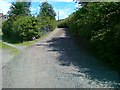
1
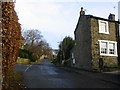
Sharp Lane Almondbury
Sharp Lane Almondbury at its junction with Lumb Lane looking NE.
Image: © Sue Trescott
Taken: 23 Dec 2005
0.04 miles
2
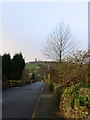
Lumb Lane Almondbury
Lumb Lane Almondbury looking WSW to Victoria Tower Castle Hill.
Image: © Sue Trescott
Taken: 23 Dec 2005
0.09 miles
3
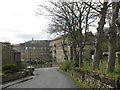
Northfield Mills, Almondbury Common
'Fancy woollen' manufacture, according to Old Maps. Castle Hill in the background
Image: © John Slater
Taken: 9 Apr 2014
0.09 miles
4
Almondbury Common.
Just a small piece left of the original Common Land.
Image: © Stanley Walker
Taken: 14 Mar 2007
0.13 miles
6
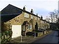
Weavers Cottages Lumb Lane Almondbury
Weavers Cottages Lumb Lane Almondbury note the upper windows (some have been bricked up -window tax?) to give plenty of light for the hand loom weavers.
Image: © Sue Trescott
Taken: 23 Dec 2005
0.15 miles
7
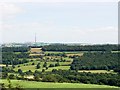
View East from Castle Hill
I was brought up with the fact that if one could look Eastward from here with the horizon levelled and through glasses strong enough one would be capable of seeing as far as the Ural Mountains without any obstruction; I don't know how true this is but there it is.
Image: © Stanley Walker
Taken: 21 Jul 2008
0.20 miles
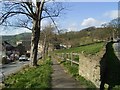
8
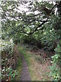
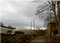
Footpath, Wheat Royd, Almondbury.
Footpath leading from Wheat Royd to Lumb Lane. A grand old oak tree overhangs the path just here.
Image: © Samantha Waddington
Taken: 29 Aug 2011
0.22 miles
9
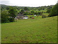
Fields near Lumb Lane
Looking across fields from the public footpath that runs from Wheat Royd to Lumb Lane.
Image: © Samantha Waddington
Taken: 30 May 2011
0.22 miles
10
Polytunnels on Lumb Lane Almondbury, Huddersfield
Image: © Steve Fareham
Taken: 21 Feb 2009
0.23 miles