IMAGES TAKEN NEAR TO
Edale Avenue, HUDDERSFIELD, HD4 6LL
Introduction
This page details the photographs taken nearby to Edale Avenue, HD4 6LL by members of the Geograph project.
The Geograph project started in 2005 with the aim of publishing, organising and preserving representative images for every square kilometre of Great Britain, Ireland and the Isle of Man.

There are currently over 7.5m images from over14,400 individuals and you can help contribute to the project by visiting https://www.geograph.org.uk
Image Map
Images are licensed for reuse under creativecommons.org/licenses/by-sa/2.0
Notes
- Clicking on the map will re-center to the selected point.
- The higher the marker number, the further away the image location is from the centre of the postcode.
Image Listing (50 Images Found)
Images are licensed for reuse under creativecommons.org/licenses/by-sa/2.0
Image
Details
Distance
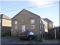
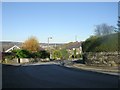
1
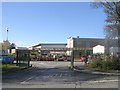
Edale Avenue, Newsome
Part of the Blagden Farm council estate.
Image: © Stephen Craven
Taken: 25 Sep 2022
0.03 miles
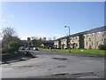
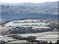
3
Towngate - viewed from Castle Avenue
Image: © Betty Longbottom
Taken: 10 Nov 2010
0.07 miles
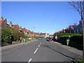
4
Close Hill Lane - viewed from Castle Avenue
Image: © Betty Longbottom
Taken: 10 Nov 2010
0.09 miles
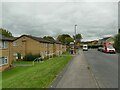
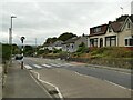
7
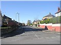
Castle Avenue - Newsome Road South
Image: © Betty Longbottom
Taken: 10 Nov 2010
0.13 miles
8
Castle Hill School - Newsome Road South
Image: © Betty Longbottom
Taken: 10 Nov 2010
0.13 miles
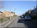
9
Zebra crossing on Newsome Road South
Probably provided mainly for students at the nearby school.
Image: © Stephen Craven
Taken: 25 Sep 2022
0.13 miles