IMAGES TAKEN NEAR TO
Lockwood Scar, HUDDERSFIELD, HD4 6BA
Introduction
This page details the photographs taken nearby to Lockwood Scar, HD4 6BA by members of the Geograph project.
The Geograph project started in 2005 with the aim of publishing, organising and preserving representative images for every square kilometre of Great Britain, Ireland and the Isle of Man.

There are currently over 7.5m images from over14,400 individuals and you can help contribute to the project by visiting https://www.geograph.org.uk
Image Map
Images are licensed for reuse under creativecommons.org/licenses/by-sa/2.0
Notes
- Clicking on the map will re-center to the selected point.
- The higher the marker number, the further away the image location is from the centre of the postcode.
Image Listing (126 Images Found)
Images are licensed for reuse under creativecommons.org/licenses/by-sa/2.0
Image
Details
Distance
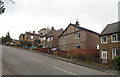
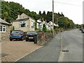
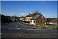
2
Bus stop on Lockwood Scar
On a very steep hill.
Image: © JThomas
Taken: 8 Nov 2018
0.02 miles
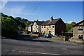
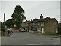
3
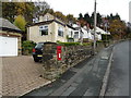
Houses on Lockwood Scar
Showing position of Postbox No. HD4 240.
See Image] for postbox.
Image: © JThomas
Taken: 8 Nov 2018
0.03 miles
4
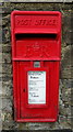
Elizabeth II postbox on Lockwood Scar
Postbox No. HD4 240.
See Image] for context.
Image: © JThomas
Taken: 8 Nov 2018
0.03 miles
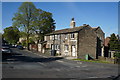
5
Postbox on Lockwood Scar
Set into a stone gatepost.
Image: © Stephen Craven
Taken: 25 Sep 2022
0.03 miles
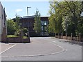
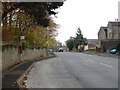
10
Barcroft Road, Newsome
Two of the three tall trees shown in Image have been demolished since 2015.
Image: © Stephen Craven
Taken: 25 Sep 2022
0.08 miles