IMAGES TAKEN NEAR TO
Cowcliffe Hill Road, HUDDERSFIELD, HD2 2PL
Introduction
This page details the photographs taken nearby to Cowcliffe Hill Road, HD2 2PL by members of the Geograph project.
The Geograph project started in 2005 with the aim of publishing, organising and preserving representative images for every square kilometre of Great Britain, Ireland and the Isle of Man.

There are currently over 7.5m images from over14,400 individuals and you can help contribute to the project by visiting https://www.geograph.org.uk
Image Map (Loading...)


Getting Data...Please wait
Leaflet Map data © OpenStreetMap
Images are licensed for reuse under creativecommons.org/licenses/by-sa/2.0
Notes
- Clicking on the map will re-center to the selected point.
- The higher the marker number, the further away the image location is from the centre of the postcode.
Image Listing (70 Images Found)
Images are licensed for reuse under creativecommons.org/licenses/by-sa/2.0
Image
Details
Distance
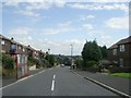
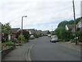
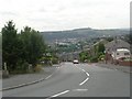
1
Cowcliffe Hill Road - viewed from Brayside Avenue
Image: © Betty Longbottom
Taken: 7 Aug 2009
0.03 miles
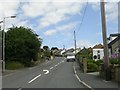
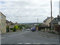
2
Brayside Avenue - Cowcliffe Hill Road
Image: © Betty Longbottom
Taken: 7 Aug 2009
0.05 miles
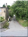
3
South Cross Road - viewed from Coach Road
Image: © Betty Longbottom
Taken: 7 Aug 2009
0.06 miles
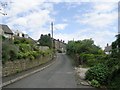
4
Highcliffe Avenue - North Cross Road
Image: © Betty Longbottom
Taken: 7 Aug 2009
0.07 miles
5
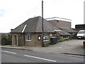
Cowcliffe and Netheroyd Hill Liberal Club, Fartown
Dated 1924
Image: © Humphrey Bolton
Taken: 28 Apr 2006
0.08 miles
6
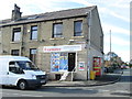
Cowcliffe Convenience Store - Cowcliffe Hill Road
Image: © Betty Longbottom
Taken: 29 Oct 2014
0.08 miles
7
Knaresborough Drive - viewed from Hammerton Road
Image: © Betty Longbottom
Taken: 31 Mar 2015
0.08 miles
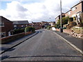
8
Cowcliffe Hill Road - viewed from Brayside Avenue
Image: © Betty Longbottom
Taken: 7 Aug 2009
0.08 miles
9
Nether Royd Hill Road - Cowcliffe Hill Road
Image: © Betty Longbottom
Taken: 7 Aug 2009
0.09 miles