IMAGES TAKEN NEAR TO
Broomfield Road, HUDDERSFIELD, HD2 2HG
Introduction
This page details the photographs taken nearby to Broomfield Road, HD2 2HG by members of the Geograph project.
The Geograph project started in 2005 with the aim of publishing, organising and preserving representative images for every square kilometre of Great Britain, Ireland and the Isle of Man.

There are currently over 7.5m images from over14,400 individuals and you can help contribute to the project by visiting https://www.geograph.org.uk
Image Map (Loading...)


Getting Data...Please wait
Leaflet Map data © OpenStreetMap
Images are licensed for reuse under creativecommons.org/licenses/by-sa/2.0
Notes
- Clicking on the map will re-center to the selected point.
- The higher the marker number, the further away the image location is from the centre of the postcode.
Image Listing (66 Images Found)
Images are licensed for reuse under creativecommons.org/licenses/by-sa/2.0
Image
Details
Distance
1
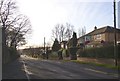
Saint Francis Gardens, Fixby
This housing development was built in the grounds of Broomfield House.
Image: © Humphrey Bolton
Taken: 14 Jan 2007
0.02 miles
2
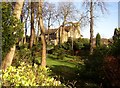
Broomfield House, Fixby
The Italianate tower suggests that this was built as a mill-owner's house in the late 19C.
Image: © Humphrey Bolton
Taken: 14 Jan 2007
0.02 miles
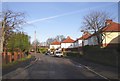
3
Broomfield Road, Fixby, looking southwards
This road is on the line of the drive to Broomfield House, the garage of which is on the left.
Image: © Humphrey Bolton
Taken: 14 Jan 2007
0.05 miles
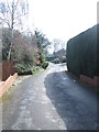
4
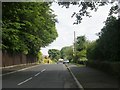
Broomfield Road, Fixby, looking northwards
This part of Broomfield Road was a narrow lane in 1895. Part of the wall surrounding the grounds of Broomfield House can be seen on the right, and the pillar box opposite the shop on Fixby Road is in the distance.
Image: © Humphrey Bolton
Taken: 14 Jan 2007
0.05 miles
7
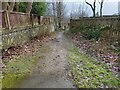
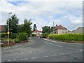
Footpath in Fixby, near Jilly Royd House
Image: © yorkshirelad
Taken: 29 Jan 2021
0.10 miles
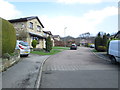
8
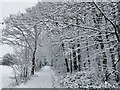
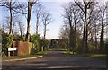
Path / road alongside Upper Fell Greave Woods in snow
Image: © yorkshirelad
Taken: 14 Jan 2021
0.11 miles