IMAGES TAKEN NEAR TO
Highfield Close, HUDDERSFIELD, HD2 2GN
Introduction
This page details the photographs taken nearby to Highfield Close, HD2 2GN by members of the Geograph project.
The Geograph project started in 2005 with the aim of publishing, organising and preserving representative images for every square kilometre of Great Britain, Ireland and the Isle of Man.

There are currently over 7.5m images from over14,400 individuals and you can help contribute to the project by visiting https://www.geograph.org.uk
Image Map (Loading...)


Getting Data...Please wait
Leaflet Map data © OpenStreetMap
Images are licensed for reuse under creativecommons.org/licenses/by-sa/2.0
Notes
- Clicking on the map will re-center to the selected point.
- The higher the marker number, the further away the image location is from the centre of the postcode.
Image Listing (59 Images Found)
Images are licensed for reuse under creativecommons.org/licenses/by-sa/2.0
Image
Details
Distance
1
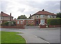
Fixbees Nursery, Fixby
As more families have working mothers, nursery care for young children is needed. Here advantage has been taken of the extra space that a house on an outside corner site has.
Image: © Humphrey Bolton
Taken: 1 Sep 2006
0.07 miles
2
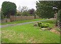
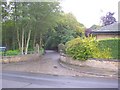
Evidence of an old boundary, Fixby
Here there was formerly a kink in the road, and therefore the stile (on the left), and the lower part of a stone wall (to the right) are probably part of the old highway boundary, which was also the boundary between Fixby and Rastrick.
Image: © Humphrey Bolton
Taken: 1 Sep 2006
0.07 miles
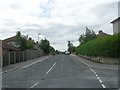
4
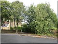
Gernhill Avenue, Fixby
This junction, made for a side road that never happened, has become overgrown by trees.
Image: © Humphrey Bolton
Taken: 1 Sep 2006
0.11 miles
5
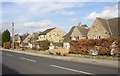
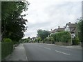
Houses, Lightridge Road, Fixby
Examples of houses faced with 'crazy paving' stonework.
Image: © Humphrey Bolton
Taken: 8 Mar 2007
0.13 miles
6
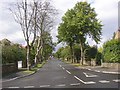
Gernhill Avenue, Fixby
This residential road, seen here from Lightridge Road, has up-market houses in various styles, the earliest built possibly in the 1940s. The road is in a strip of land that was just in Huddersfield County Borough.
Image: © Humphrey Bolton
Taken: 1 Sep 2006
0.13 miles
7
Entrance to Huddersfield Golf Club, Fixby
The lodge was built for Fixby Hall, now the clubhouse.
Image: © Humphrey Bolton
Taken: 1 Sep 2006
0.13 miles
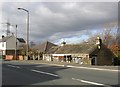
8
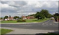
Fixby Green
This is not an old village green, but a modern creation probably at the time of the housing development. Was this due to the good old days of pro-active town planning?
Image: © Humphrey Bolton
Taken: 19 Aug 2005
0.13 miles
10
Cottage below the road, Clough Lane, Rastrick
Here it is evident that the road has been raised and /or widened, and the old cottage is considerably below the present road level. Note that although this is now in the Kirklees Metropolitan Council area, it is within the old boundary of Rastrick.
Image: © Humphrey Bolton
Taken: 26 Feb 2007
0.14 miles