IMAGES TAKEN NEAR TO
The Muirlands, HUDDERSFIELD, HD2 1PN
Introduction
This page details the photographs taken nearby to The Muirlands, HD2 1PN by members of the Geograph project.
The Geograph project started in 2005 with the aim of publishing, organising and preserving representative images for every square kilometre of Great Britain, Ireland and the Isle of Man.

There are currently over 7.5m images from over14,400 individuals and you can help contribute to the project by visiting https://www.geograph.org.uk
Image Map (Loading...)


Getting Data...Please wait
Leaflet Map data © OpenStreetMap
Images are licensed for reuse under creativecommons.org/licenses/by-sa/2.0
Notes
- Clicking on the map will re-center to the selected point.
- The higher the marker number, the further away the image location is from the centre of the postcode.
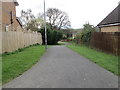
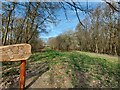
Image Listing (49 Images Found)
Images are licensed for reuse under creativecommons.org/licenses/by-sa/2.0
Image
Details
Distance
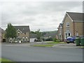
9
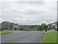
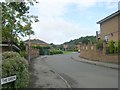
Looking down Redwood Drive - from Langsett Croft
Image: © Betty Longbottom
Taken: 10 Aug 2009
0.13 miles
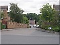
10
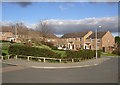
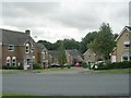
The Green, Bradley, Huddersfield
A landscaped area justifies the street name. The little circular windows are a distinctive feature of these houses.
Image: © Humphrey Bolton
Taken: 26 Feb 2007
0.13 miles