1
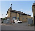
The Yorkshire Rose, Huddersfield
Near Travelodge Huddersfield Hotel.
Image: © JThomas
Taken: 6 Dec 2014
0.02 miles
2
A62 Leeds Road, Huddersfield
Image: © Mark Anderson
Taken: 20 Apr 2019
0.02 miles
3
Former St Andrew's church, Leeds Road, Huddersfield
The church was built in 1870, architect W.H. Crossland of Leeds. It was declared redundant in 1975, and listed grade II after closure (current list entry 1214957). Initially sold, along with the adjacent site of the now-demolished church school, to the Roman Catholics, following a fire the building was sold again in 2003 and permission was granted in 2007 for conversion to office or retail use, but it appears still to be disused.
Image: © Stephen Craven
Taken: 25 Jan 2020
0.02 miles
4
Sign for the Yorkshire Rose, Huddersfield
Image: © JThomas
Taken: 6 Dec 2014
0.03 miles
5
Travelodge Huddersfield Hotel
Image: © JThomas
Taken: 6 Dec 2014
0.04 miles
6
Detail of St Andrew's Church, Leeds Road A62, Fartown, Huddersfield
This is the transept gable and window of the former St Andrew's Anglican church in a site being redeveloped.
Image: © Humphrey Bolton
Taken: 17 Apr 2008
0.04 miles
7
Disused church, Leeds Road A62, Fartown, Huddersfield
The former St Andrew's Anglican church is in a site, including a former chemical factory, that is currently being redeveloped.
The church was built in 1870, designed by W.H. Crossland of Leeds. It was declared redundant in 1975, after which it was used by a local Roman-Catholic congregation until c.2001.
More detail in http://list.english-heritage.org.uk/resultsingle.aspx?uid=1214957&searchtype=mapsearch
Photographs in http://www.28dayslater.co.uk/forums/showthread.php?t=22290
and http://www.urbexforums.co.uk/showthread.php/13591-St-Andrews-Church-Huddersfield-West-Yorkshire-30-05-2011
Image: © Humphrey Bolton
Taken: 17 Apr 2008
0.04 miles
8
Motorspares car park on Thistle Street
Image: © Andrew Tatlow
Taken: 25 Jul 2019
0.05 miles
9
Houses on Thistle Street
Image: © Andrew Tatlow
Taken: 25 Jul 2019
0.05 miles
10
Hillhouse Lane, Huddersfield Broad Canal
Image: © yorkshirelad
Taken: 10 Jan 2021
0.06 miles


