IMAGES TAKEN NEAR TO
Blacker Road, HUDDERSFIELD, HD1 5HH
Introduction
This page details the photographs taken nearby to Blacker Road, HD1 5HH by members of the Geograph project.
The Geograph project started in 2005 with the aim of publishing, organising and preserving representative images for every square kilometre of Great Britain, Ireland and the Isle of Man.

There are currently over 7.5m images from over14,400 individuals and you can help contribute to the project by visiting https://www.geograph.org.uk
Image Map
Images are licensed for reuse under creativecommons.org/licenses/by-sa/2.0
Notes
- Clicking on the map will re-center to the selected point.
- The higher the marker number, the further away the image location is from the centre of the postcode.
Image Listing (110 Images Found)
Images are licensed for reuse under creativecommons.org/licenses/by-sa/2.0
Image
Details
Distance
2
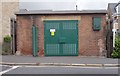
Electricity Substation No 351 - Blacker Road North
Image: © Betty Longbottom
Taken: 24 Aug 2015
0.04 miles
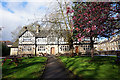
3
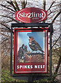
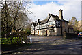
Spinks Nest
Blacker Road, Huddersfield. http://www.geograph.org.uk/photo/5753973
Image: © Ian S
Taken: 25 Apr 2018
0.05 miles
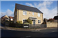
4
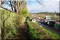
Public footpath towards Blacker Road, Huddersfield
Image: © Ian S
Taken: 25 Apr 2018
0.05 miles
5
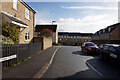
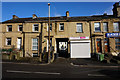
Britannia Crescent off Birkby Lodge Road, Huddersfield
Image: © Ian S
Taken: 25 Apr 2018
0.05 miles
6
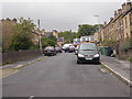
Spinkfield Road - Birkby Lodge Road
Image: © Betty Longbottom
Taken: 24 Aug 2015
0.05 miles
7
Britannia Crescent - Birkby Lodge Road
Image: © Betty Longbottom
Taken: 24 Aug 2015
0.06 miles
8
Spinks Nest
Blacker Road, Huddersfield. http://www.geograph.org.uk/photo/5753975
Image: © Ian S
Taken: 25 Apr 2018
0.06 miles
9
Spinks Nest
Blacker Road, Huddersfield. http://www.geograph.org.uk/photo/5753975
Image: © Ian S
Taken: 25 Apr 2018
0.06 miles
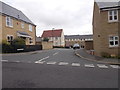
10
Britannia Crescent off Birkby Lodge Road, Huddersfield
Image: © Ian S
Taken: 25 Apr 2018
0.06 miles