IMAGES TAKEN NEAR TO
The Drive, WEMBLEY, HA9 9EQ
Introduction
This page details the photographs taken nearby to The Drive, HA9 9EQ by members of the Geograph project.
The Geograph project started in 2005 with the aim of publishing, organising and preserving representative images for every square kilometre of Great Britain, Ireland and the Isle of Man.

There are currently over 7.5m images from over14,400 individuals and you can help contribute to the project by visiting https://www.geograph.org.uk
Image Map
Images are licensed for reuse under creativecommons.org/licenses/by-sa/2.0
Notes
- Clicking on the map will re-center to the selected point.
- The higher the marker number, the further away the image location is from the centre of the postcode.
Image Listing (60 Images Found)
Images are licensed for reuse under creativecommons.org/licenses/by-sa/2.0
Image
Details
Distance
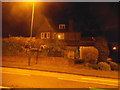
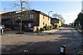
1
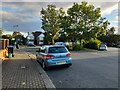
Mount Drive, Wembley Park
Looking towards Forty Avenue
Image: © David Howard
Taken: 29 Sep 2021
0.10 miles
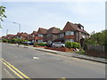
2
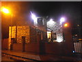
House on The Drive, Wembley Park
An impressive display of stone cladding, if you like that sort of thing.
Image: © David Howard
Taken: 20 Nov 2015
0.12 miles
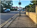
7
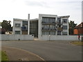
Block of flats on Chalkhill Road, Wembley Park
Image: © David Howard
Taken: 31 Jul 2014
0.16 miles
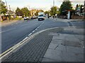
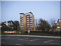
8
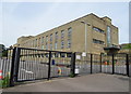
Lyc?e International de Londres Winston Churchill
French international school in the former Brent Town Hall.
Image: © JThomas
Taken: 3 Aug 2019
0.17 miles
10
Tower block by Asda on the Chalkhill estate
Image: © David Howard
Taken: 7 Nov 2014
0.18 miles