IMAGES TAKEN NEAR TO
Park View, WEMBLEY, HA9 6JU

Introduction

This page details the photographs taken nearby to Park View, HA9 6JU by members of the Geograph project.

The Geograph project started in 2005 with the aim of publishing, organising and preserving representative images for every square kilometre of Great Britain, Ireland and the Isle of Man.

There are currently over 7.5m images from over14,400 individuals and you can help contribute to the project by visiting https://www.geograph.org.uk

Image Map


Images are licensed for reuse under creativecommons.org/licenses/by-sa/2.0
Notes
  • Clicking on the map will re-center to the selected point.
  • The higher the marker number, the further away the image location is from the centre of the postcode.

Image Listing (95 Images Found)

Images are licensed for reuse under creativecommons.org/licenses/by-sa/2.0
  • ...
Image
Details
Distance
1
Sidings, Wembley Stadium
Image: © N Chadwick Taken: 19 Nov 2016
0.04 miles
2
Engine shed, Wembley Stadium
Image: © N Chadwick Taken: 19 Nov 2016
0.04 miles
3
Bridge over the former Wembley Loop Line
A bridge over the former railway line that formed a loop to Wembley Stadium. Today, a factory stands on the trackbed.
Image: © Gareth James Taken: 23 Jul 2014
0.09 miles
4
Wembley Sidings
Image: © N Chadwick Taken: 7 Apr 2018
0.10 miles
5
Second Way, Wembley
Image: © David Howard Taken: 7 Aug 2014
0.11 miles
6
Grove Way
Image: © Des Blenkinsopp Taken: 7 Apr 2014
0.13 miles
7
Unlikely neighbours
Wembley Stadium, seen from the industrial estate round the back. It seems odd that a prestigious venue like this should find itself being jostled by such scruffy neighbours.
Image: © Antony Dixon Taken: 15 Dec 2011
0.15 miles
8
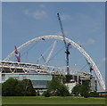
Wembley Stadium Arch under construction
View from Sherrans Farm open space, a quarter mile south-east of the stadium
Image: © David Hawgood Taken: 7 Jun 2005
0.15 miles
9
Wembley Stadium under construction
View from Sherrans Farm Open Space
Image: © David Hawgood Taken: 7 Jun 2005
0.15 miles
10
Oakington Manor Drive, Tokyngton
The 1920 OS map shows this as farmland belonging to Oakington Farm, and the farm is there on the 1935 map with this development of houses. The site of Oakington Farm is now Sherrans Farm Open Space (why the changed name?)
Image: © David Smith Taken: 23 Nov 2017
0.15 miles
  • ...