IMAGES TAKEN NEAR TO
Longcrofte Road, EDGWARE, HA8 6RR
Introduction
This page details the photographs taken nearby to Longcrofte Road, HA8 6RR by members of the Geograph project.
The Geograph project started in 2005 with the aim of publishing, organising and preserving representative images for every square kilometre of Great Britain, Ireland and the Isle of Man.

There are currently over 7.5m images from over14,400 individuals and you can help contribute to the project by visiting https://www.geograph.org.uk
Image Map
Images are licensed for reuse under creativecommons.org/licenses/by-sa/2.0
Notes
- Clicking on the map will re-center to the selected point.
- The higher the marker number, the further away the image location is from the centre of the postcode.
Image Listing (79 Images Found)
Images are licensed for reuse under creativecommons.org/licenses/by-sa/2.0
Image
Details
Distance
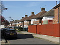
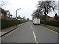
2
Cloyster Wood, Stanmore
A short residential street. Named after what was here before perhaps?
Image: © Des Blenkinsopp
Taken: 4 Sep 2019
0.07 miles
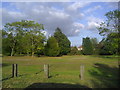
3
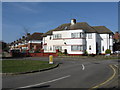
Semi-detached magnificence
A fascinating architectural piece in Canons Park at the corner of Longcrofte Road and Watersfield Way.
Image: © Peter Whatley
Taken: 1 Apr 2012
0.07 miles
5
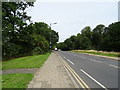
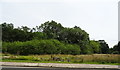
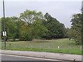
Stanmore Marsh
Improvement works were taking place in the autumn to ready this public open space for the following spring.
Image: © Christopher Hilton
Taken: 22 Sep 2016
0.07 miles
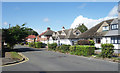
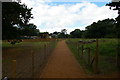
9
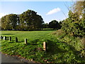
Stanmore Marsh
Stanmore Marsh is former common land that is shown on maps from the late 16th century onwards. Today what remains of the marsh as open land is on the east of where Marsh Lane becomes Honeypot Lane, and is divided into two sections by Whitchurch Lane. It appears that it was once at the boundary of the adjoining parishes of Great Stanmore and Little Stanmore and was grazed by the livestock of commoners from both parishes. It is seen here from Whitchurch Lane.
More information can be found at http://www.londongardensonline.org.uk/gardens-online-record.asp?ID=HRW050
Image: © Marathon
Taken: 28 Oct 2015
0.09 miles