IMAGES TAKEN NEAR TO
Sandy Lodge Lane, NORTHWOOD, HA6 2HU
Introduction
This page details the photographs taken nearby to Sandy Lodge Lane, HA6 2HU by members of the Geograph project.
The Geograph project started in 2005 with the aim of publishing, organising and preserving representative images for every square kilometre of Great Britain, Ireland and the Isle of Man.

There are currently over 7.5m images from over14,400 individuals and you can help contribute to the project by visiting https://www.geograph.org.uk
Image Map
Images are licensed for reuse under creativecommons.org/licenses/by-sa/2.0
Notes
- Clicking on the map will re-center to the selected point.
- The higher the marker number, the further away the image location is from the centre of the postcode.
Image Listing (26 Images Found)
Images are licensed for reuse under creativecommons.org/licenses/by-sa/2.0
Image
Details
Distance
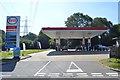
1
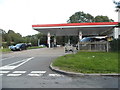
Petrol station on Sandy Lodge Lane, Moor Park
Image: © David Howard
Taken: 11 Sep 2017
0.01 miles
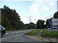
2
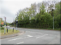
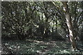
Sandy Lodge Lane
This is the entrance to the Moor Park estate but although cars can drive in they can't drive through it.
Image: © David Howard
Taken: 30 Aug 2012
0.01 miles
4
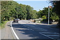
The junction of Hampermill Lane and Sandy Lane, Moor Park
Image: © David Howard
Taken: 11 Sep 2017
0.02 miles
5
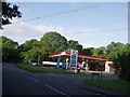
Energy energy
Petrol station with overhead electricity cables
Image: © Bikeboy
Taken: 23 Jun 2012
0.02 miles
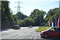
8
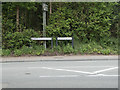
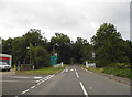
Junction of Hampermill Lane and Sandy Lane, Moor Park
As seen from Sandy Lodge Lane.
Image: © Christine Matthews
Taken: 20 Apr 2017
0.05 miles