IMAGES TAKEN NEAR TO
Christchurch Avenue, HARROW, HA3 5BD

Introduction

This page details the photographs taken nearby to Christchurch Avenue, HA3 5BD by members of the Geograph project.

The Geograph project started in 2005 with the aim of publishing, organising and preserving representative images for every square kilometre of Great Britain, Ireland and the Isle of Man.

There are currently over 7.5m images from over14,400 individuals and you can help contribute to the project by visiting https://www.geograph.org.uk

Image Map


Images are licensed for reuse under creativecommons.org/licenses/by-sa/2.0
Notes
  • Clicking on the map will re-center to the selected point.
  • The higher the marker number, the further away the image location is from the centre of the postcode.

Image Listing (26 Images Found)

Images are licensed for reuse under creativecommons.org/licenses/by-sa/2.0
  • ...
Image
Details
Distance
1
Harrow Leisure Centre
Image: © Stacey Harris Taken: 13 Oct 2012
0.03 miles
2
Car park entrance, Harrow Leisure Centre
The entrance to the car park at Harrow Leisure Centre.
Image: © Malc McDonald Taken: 7 Nov 2010
0.05 miles
3
Graffiti on the Skate Park
These places are always heavily graffitied. I guess it goes with the territory.
Image: © Des Blenkinsopp Taken: 4 Sep 2019
0.08 miles
4
Harrow Leisure Centre
In Christchurch Avenue, full details of this London Borough of Harrow facility can be found here http://www.harrow.gov.uk/ccm/content/leisure-and-culture/sports-services/harrow-leisure-centre.en
Image: © Nigel Cox Taken: 11 Jan 2006
0.08 miles
5
Wealdstone: Byron Park skateboard pit
Bleak.
Image: © Nigel Cox Taken: 1 Dec 2010
0.09 miles
6
Masons Avenue, Wealdstone
Image: © David Howard Taken: 13 Jan 2021
0.12 miles
7
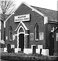
Wealdstone Evangelical Church
Built in 1928.
Image: © Jim Osley Taken: 26 Oct 2019
0.13 miles
8
Wealdstone: Former driving school site
If you look at satellite imagery currently available online you can see the layout of the driving school as it was, complete with road junctions, roundabouts, pedestrian crossings and even a ramp for practising hill starts. Today it lies derelict and only a couple of forlorn traffic lights and a leaning Belisha Beacon post bear silent witness to its past. Minutes of a local council meeting in 2004 refer to it as closed so it is at least 6 years since it was last used.
Image: © Nigel Cox Taken: 1 Dec 2010
0.13 miles
9
Former railway embankment, Wealdstone
The mound across the road once formed a railway embankment. The railway was a branch line running from Harrow & Wealdstone to Stanmore Village, which closed in 1964.
Image: © Malc McDonald Taken: 7 Nov 2010
0.14 miles
10
Christchurch Avenue, Wealdstone
Image: © Stacey Harris Taken: 13 Oct 2012
0.15 miles
  • ...