IMAGES TAKEN NEAR TO
Brookfield Crescent, HARROW, HA3 0UT
Introduction
This page details the photographs taken nearby to Brookfield Crescent, HA3 0UT by members of the Geograph project.
The Geograph project started in 2005 with the aim of publishing, organising and preserving representative images for every square kilometre of Great Britain, Ireland and the Isle of Man.

There are currently over 7.5m images from over14,400 individuals and you can help contribute to the project by visiting https://www.geograph.org.uk
Image Map
Images are licensed for reuse under creativecommons.org/licenses/by-sa/2.0
Notes
- Clicking on the map will re-center to the selected point.
- The higher the marker number, the further away the image location is from the centre of the postcode.
Image Listing (24 Images Found)
Images are licensed for reuse under creativecommons.org/licenses/by-sa/2.0
Image
Details
Distance
2
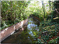
Bridge over Wealdstone Brook
Between Shaftesbury Avenue and Lidding Road
Image: © David Howard
Taken: 23 Oct 2008
0.09 miles
4
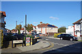
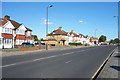
Hillview Avenue, Kenton
Junction with Cranleigh Gardens.
Image: © Des Blenkinsopp
Taken: 2 Oct 2019
0.10 miles
5
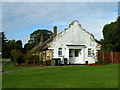
Cottages on Brookside Close
One of several short terraces on Brookside Close and very near. They are of no great age, yet the end cottages have this extraordinary end face and front door. It is a pity whoever is the landlord has not kept these in the sparkling white condition they deserve.
Image: © Robin Webster
Taken: 13 Oct 2012
0.10 miles
6
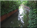
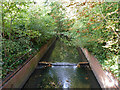
Wealdstone Brook in Kenton
A wet day and water is gushing out of the stormwater drains into the brook in this view taken as it snakes downstream from the footbridge linking Shaftesbury Drive with Lidding Road. The brook is certainly wider here than downstream in the next grid square Image
Image: © Nigel Cox
Taken: 24 Jun 2007
0.11 miles
8
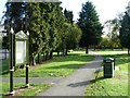
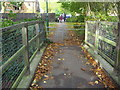
Path and notice board, Woodcock Park
The notice board is headed 'Woodcock Park MUGA'. This apparently refers to a 'Multi Use Games Area' which must be off to the left.
Image: © Robin Webster
Taken: 13 Oct 2012
0.17 miles
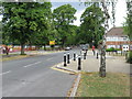
9
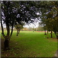
Woodcock Park, looking north west from Shaftesbury Avenue
Image: © Robert Eva
Taken: 22 Jan 2018
0.17 miles