IMAGES TAKEN NEAR TO
Lucas Avenue, HARROW, HA2 9UH
Introduction
This page details the photographs taken nearby to Lucas Avenue, HA2 9UH by members of the Geograph project.
The Geograph project started in 2005 with the aim of publishing, organising and preserving representative images for every square kilometre of Great Britain, Ireland and the Isle of Man.

There are currently over 7.5m images from over14,400 individuals and you can help contribute to the project by visiting https://www.geograph.org.uk
Image Map
Images are licensed for reuse under creativecommons.org/licenses/by-sa/2.0
Notes
- Clicking on the map will re-center to the selected point.
- The higher the marker number, the further away the image location is from the centre of the postcode.
Image Listing (24 Images Found)
Images are licensed for reuse under creativecommons.org/licenses/by-sa/2.0
Image
Details
Distance
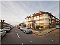
2
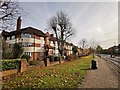
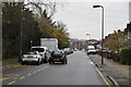
South Harrow - Alexandra Avenue
Apartment block on main road the A4090.
Image: © James Emmans
Taken: 20 Nov 2019
0.12 miles
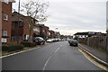
3
Rayners Lane
New flats have gone up on the left as far as the railway
Image: © David Howard
Taken: 20 Nov 2013
0.13 miles
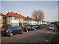
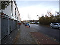
5
New flats on Rayners Lane
The construction continues on the right, there are windows in the hoardings and the shells are now complete before getting roofs and cladding.
Image: © David Howard
Taken: 20 Nov 2013
0.16 miles
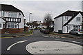
6
1950's Block of Flats
On the corner of Capthorne Avenue and Alexandra Avenue.
Image: © James Emmans
Taken: 20 Nov 2019
0.16 miles
7
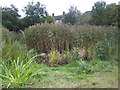
Rayners Lane: Newton Farm Ecology Park
Hidden away behind the flats on the east side of Alexandra Avenue, (visible over the trees here), is Newton Farm Ecology Park. This was originally haymaking farmland and then a Victorian sewage farm, and is marked as such on the OS 1940s mapping. A remnant of this area, alongside The Roxbourne brook, was not been built over during the suburban sprawl that followed the arrival of the Metropolitan railway line. Today the area is managed to try to bring back various species of wildlife that have disappeared. This is the pond with its small reed bed. A large part of the area of the ecology park is also designed to be a flood storage area in case The Roxbourne bursts its banks.
Image: © Nigel Cox
Taken: 24 Oct 2007
0.17 miles