
IMAGES TAKEN NEAR TO
Lynton Road, HARROW, HA2 9NS
Introduction
This page details the photographs taken nearby to Lynton Road, HA2 9NS by members of the Geograph project.
The Geograph project started in 2005 with the aim of publishing, organising and preserving representative images for every square kilometre of Great Britain, Ireland and the Isle of Man.

There are currently over 7.5m images from over14,400 individuals and you can help contribute to the project by visiting https://www.geograph.org.uk
Image Map
Images are licensed for reuse under creativecommons.org/licenses/by-sa/2.0
Notes
- Clicking on the map will re-center to the selected point.
- The higher the marker number, the further away the image location is from the centre of the postcode.
Image Listing (30 Images Found)
Images are licensed for reuse under creativecommons.org/licenses/by-sa/2.0
Image
Details
Distance
1
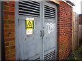
Electricity sub station rear of Dunster Way
Image: © Alex McGregor
Taken: 14 Feb 2013
0.12 miles
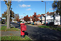
3
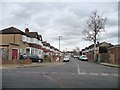
Silver birch on Dunster Way
Looking east from the junction with Torbay Road. Most of the streets in this estate are named after places in Somerset and Devon.
Image: © Christine Johnstone
Taken: 8 Mar 2016
0.14 miles
4
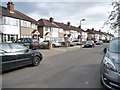
Houses in blocks of six, Torbay Road
On the east side of the road, south of Dunster Way.
Image: © Christine Johnstone
Taken: 8 Mar 2016
0.17 miles
5
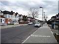
Houses in blocks of three, Torbay Road
Unusual in most suburbs, but quite common on this estate.
Image: © Christine Johnstone
Taken: 8 Mar 2016
0.18 miles
6
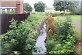
The Roxbourne, South Harrow
Viewed looking upstream from the Malvern Avenue road bridge as it comes through Newton Park.
Image: © Nigel Cox
Taken: 27 Jul 2005
0.18 miles
7
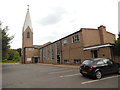
St Andrews Church, Roxbourne (2)
This Parish Church in Malvern Avenue HA2 9ER has its main Sunday Service at 9.45am with a Holy Communion service at taking place at 8.00am the same day. Activities are held in this Church during the week.
Image: © David Hillas
Taken: 18 Aug 2016
0.20 miles
8
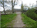
Looking towards the entrance to Newton Park (West)
Newton Park (West) consists of open space either side of The Roxbourne river which was left when the adjacent post-war council housing was built. The Roxbourne, which is its main feature, is also known as the eastern arm of the Yeading Brook. It rises near North Harrow and converges with the Yeading Brook in Ruislip on the southern side of Western Avenue. This in turn flows into the River Crane which reaches the Thames at Isleworth.
See http://www.londonslostrivers.com/yeading-brook.html for more information and photographs of The Roxbourne.
In this view The Roxbourne is on the right while the Parish Church of St Andrew Roxbourne can be seen across Malvern Avenue. The church was opened in October 1957. Its full history can be read at http://www.standrewsroxbourne.org.uk/our-values/history/
Image: © Marathon
Taken: 13 Apr 2016
0.20 miles
9
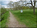
View from the entrance to Newton Park (West)
Newton Park (West) consists of open space either side of The Roxbourne river which was left when the adjacent post-war council housing was built. The Roxbourne, which is its main feature, is also known as the eastern arm of the Yeading Brook. It rises near North Harrow and converges with the Yeading Brook in Ruislip on the southern side of Western Avenue. This in turn flows into the River Crane which reaches the Thames at Isleworth.
See http://www.londonslostrivers.com/yeading-brook.html for more information and photographs of The Roxbourne.
In this view from the entrance in Malvern Avenue, The Roxbourne is on the left. The view in the other direction to the park entrance with the Parish Church of St Andrew Roxbourne opposite can be seen at http://www.geograph.org.uk/photo/4907411
Image: © Marathon
Taken: 13 Apr 2016
0.20 miles
10
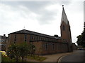
St Andrews Church, Roxbourne (1)
Situated in Malvern Avenue HA2 9ER, this Parish Church was opened in October 1957 with the first foundations having already been laid in 1954. The spire with the cross on its top is a feature of this Church.
Image: © David Hillas
Taken: 18 Aug 2016
0.20 miles