IMAGES TAKEN NEAR TO
Spencer Road, WEMBLEY, HA0 3SE
Introduction
This page details the photographs taken nearby to Spencer Road, HA0 3SE by members of the Geograph project.
The Geograph project started in 2005 with the aim of publishing, organising and preserving representative images for every square kilometre of Great Britain, Ireland and the Isle of Man.

There are currently over 7.5m images from over14,400 individuals and you can help contribute to the project by visiting https://www.geograph.org.uk
Image Map
Images are licensed for reuse under creativecommons.org/licenses/by-sa/2.0
Notes
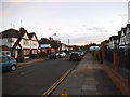
- Clicking on the map will re-center to the selected point.
- The higher the marker number, the further away the image location is from the centre of the postcode.
Image Listing (72 Images Found)
Images are licensed for reuse under creativecommons.org/licenses/by-sa/2.0
Image
Details
Distance
1
Entrance to Byron Court Primary School
Spencer Road in South Kenton.
Image: © James Emmans
Taken: 17 Nov 2019
0.01 miles
5
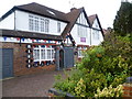
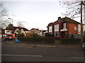
A Royalist household at North Wembley
I saw the purple sign first saying "Congratulations on the birth of your baby" and assumed it was a local event, even though this is called "Heritage House" and has a crown next to the name. Then on the other side I saw all the plaques as seen at http://www.geograph.org.uk/photo/4571821
Image: © Marathon
Taken: 15 Jul 2015
0.09 miles
6
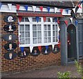
Royal plaques
This is a close up of the plaques on the house shown at http://www.geograph.org.uk/photo/4571817
Image: © Marathon
Taken: 15 Jul 2015
0.09 miles
7
The Fairway at the entrance to Northwick Park
Image: © David Howard
Taken: 7 Nov 2014
0.12 miles
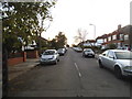
8
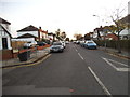
Norval Road at the junction of Audrey Gardens
Image: © David Howard
Taken: 7 Nov 2014
0.13 miles
9
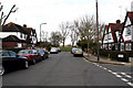
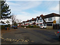
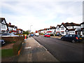
South Kenton: north end of Nathans Road
At its northerly end, Nathans Road leads onto the open space of Northwick Park, where it is a pleasant walk across to Harrow Hill, although not as pleasant now as it was fifty years ago before the hospital and college had been built. Most of the houses in Nathans Road retain the mock-tudor fronts they were given when the Sudbury Court estate was laid out here in the 1930s, but some dilution of these has occurred, even though this is a Consrvation area.
Image: © Dr Neil Clifton
Taken: 4 Mar 2010
0.14 miles