1
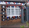
Houses on Blockley Road, Wembley
Image: © David Howard
Taken: 2 Nov 2010
0.04 miles
2
Paxford Road, North Wembley
Image: © Alex McGregor
Taken: 5 Aug 2010
0.06 miles
3
The Fairway, North Wembley
This is at the junction with Carlton Avenue West.
Image: © Marathon
Taken: 15 Jul 2015
0.08 miles
4
Abbots Drive, North Wembley
One of a number of very similar streets around here featuring much the same style of layout and architecture.
Many of the houses have the distinctive arched pattern windows as seen nearest the camera.
Image: © Des Blenkinsopp
Taken: 4 Nov 2014
0.09 miles
5
Carlton Avenue West, North Wembley
Image: © Alex McGregor
Taken: 5 Aug 2010
0.11 miles
6
Looking across The Fairway
This is North Wembley, looking from Campden Crescent across The Fairway to Holt Road on the left hand side of the photograph.
Image: © Marathon
Taken: 15 Jul 2015
0.15 miles
7
Looking across The Fairway
This is North Wembley, looking from Campden Crescent across The Fairway to Holt Road on the left hand side of the photograph.
Image: © Marathon
Taken: 15 Jul 2015
0.16 miles
8
A Royalist household at North Wembley
I saw the purple sign first saying "Congratulations on the birth of your baby" and assumed it was a local event, even though this is called "Heritage House" and has a crown next to the name. Then on the other side I saw all the plaques as seen at http://www.geograph.org.uk/photo/4571821
Image: © Marathon
Taken: 15 Jul 2015
0.18 miles
9
Royal plaques
This is a close up of the plaques on the house shown at http://www.geograph.org.uk/photo/4571817
Image: © Marathon
Taken: 15 Jul 2015
0.18 miles
10
South Kenton: Carlton Avenue West
Looking west from the Nathans Road junction. At its far end, Carlton Avenue West makes a junction with Watford Road, (A404).
Image: © Dr Neil Clifton
Taken: 4 Mar 2010
0.19 miles


