IMAGES TAKEN NEAR TO
Barham Close, WEMBLEY, HA0 2EB
Introduction
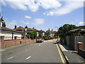
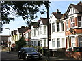
This page details the photographs taken nearby to Barham Close, HA0 2EB by members of the Geograph project.
The Geograph project started in 2005 with the aim of publishing, organising and preserving representative images for every square kilometre of Great Britain, Ireland and the Isle of Man.

There are currently over 7.5m images from over14,400 individuals and you can help contribute to the project by visiting https://www.geograph.org.uk
Image Map
Images are licensed for reuse under creativecommons.org/licenses/by-sa/2.0
Notes
- Clicking on the map will re-center to the selected point.
- The higher the marker number, the further away the image location is from the centre of the postcode.
Image Listing (175 Images Found)
Images are licensed for reuse under creativecommons.org/licenses/by-sa/2.0
Image
Details
Distance
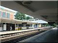
4
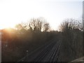
Railway lines heading to Sudbury Town
From the bridge on Harrow Road
Image: © David Howard
Taken: 11 Mar 2014
0.05 miles
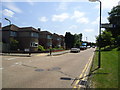
7
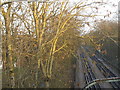
The Piccadilly Line heading towards Alperton
From Bridgewater Road
Image: © David Howard
Taken: 11 Mar 2014
0.08 miles
8

Sudbury Town tube station - roundel
See Image The original station signage uses the Johnston Delf Smith typeface http://en.academic.ru/dic.nsf/enwiki/5479537 a wedge-serif variation of the standard London Underground Johnston typeface https://en.wikipedia.org/wiki/Johnston_(typeface) .
Image: © Mike Quinn
Taken: 5 Jul 2017
0.09 miles