
IMAGES TAKEN NEAR TO
Rother Close, SANDHURST, GU47 9RH
Introduction
This page details the photographs taken nearby to Rother Close, GU47 9RH by members of the Geograph project.
The Geograph project started in 2005 with the aim of publishing, organising and preserving representative images for every square kilometre of Great Britain, Ireland and the Isle of Man.

There are currently over 7.5m images from over14,400 individuals and you can help contribute to the project by visiting https://www.geograph.org.uk
Image Map
Images are licensed for reuse under creativecommons.org/licenses/by-sa/2.0
Notes
- Clicking on the map will re-center to the selected point.
- The higher the marker number, the further away the image location is from the centre of the postcode.
Image Listing (52 Images Found)
Images are licensed for reuse under creativecommons.org/licenses/by-sa/2.0
Image
Details
Distance
1
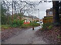
Path to Evenlode Way
A path off the cycle way / path at Snaprails Park to Evenlode Way, a road between Rackstraw Road and Severn Close in Owlsmoor.
Image: © Oscar Taylor
Taken: 31 Mar 2023
0.04 miles
2
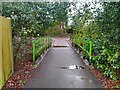
Bridge to Snaprails Park
The bridge providing foot access from Hungerford Close to Snaprails Park and the cycle way to Sandhurst.
Image: © Oscar Taylor
Taken: 31 Mar 2023
0.05 miles
3
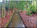
Stream in Snaprails Park
A stream to the west of the path / cycle way in Snaprails Park. The stream runs from Butter Hill to Blackwater River.
Image: © Oscar Taylor
Taken: 31 Mar 2023
0.05 miles
4

Snaprails Park
Snaprails Park, just to the west of Owlsmoor in Sandhurst.
Image: © Anonymous 4452
Taken: 20 Nov 2005
0.05 miles
5
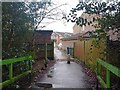
Path to Hungerford Close
A path off the cycle way / path at Snaprails Park to Hungerford Close, a cul-de-sac off Abingdon Road in Owlsmoor.
Image: © Oscar Taylor
Taken: 31 Mar 2023
0.06 miles
6
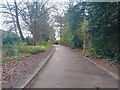
Snaprails Park path
The path leading south towards the south entrance to Snaprails Park in Sandhurst. The path (or cycle way) connects Owlsmoor and Sandhurst via the park.
Image: © Oscar Taylor
Taken: 31 Mar 2023
0.08 miles
7
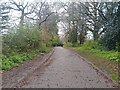
Snaprails Park path
The path leading north from the south entrance to Snaprails Park in Sandhurst. The path (or cycle way) connects Owlsmoor and Sandhurst via the park.
Image: © Oscar Taylor
Taken: 31 Mar 2023
0.11 miles
8
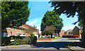
Isis Way, Sandhurst
One of a number of roads nearby which are named after rivers.
Image: © Des Blenkinsopp
Taken: 18 May 2022
0.11 miles
9
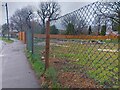
Wasteland off Wellington Road
An area of undeveloped land - now a fond favourite of flytippers - on Wellington Road in Sandhurst.
It is between the stream and 8 Wellington Road. Assumedly this was once 10 Wellington Road, before St. Marys Close was developed, with 12 Wellington Road behind. The fence and gate are recent additions, suggesting development is imminent.
Image: © Oscar Taylor
Taken: 31 Mar 2023
0.12 miles
10
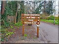
Obvious sign in Snaprails Park
Just in case anyone was confused on the walk into Snaprails Park in Sandhurst, you are going the right way! It is just a long path to get there. I don't know where else these attractions could be other than straight ahead, though. Perhaps one of the offshoot routes to housing developments?
The sign reads: "PICNIC BENCHES ↑
PLAY AREA ↑
POND ↑
WILDLIFE GLADE ↑".
Someone has graffitied over the 'E' in 'GLADE' so it reads 'GLAD'.
Image: © Oscar Taylor
Taken: 31 Mar 2023
0.12 miles