
IMAGES TAKEN NEAR TO
Wellington Road, SANDHURST, GU47 9AY
Introduction
This page details the photographs taken nearby to Wellington Road, GU47 9AY by members of the Geograph project.
The Geograph project started in 2005 with the aim of publishing, organising and preserving representative images for every square kilometre of Great Britain, Ireland and the Isle of Man.

There are currently over 7.5m images from over14,400 individuals and you can help contribute to the project by visiting https://www.geograph.org.uk
Image Map
Images are licensed for reuse under creativecommons.org/licenses/by-sa/2.0
Notes
- Clicking on the map will re-center to the selected point.
- The higher the marker number, the further away the image location is from the centre of the postcode.
Image Listing (56 Images Found)
Images are licensed for reuse under creativecommons.org/licenses/by-sa/2.0
Image
Details
Distance
1
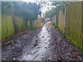
Flooded Calvert Walk
Flooding on Calvert Walk - a footpath between the corner of Beech Ride and Orchard Gate, and Wellington Road - following heavy rain.
The footpath is called Calvert Walk as underneath it (and under most of the Longdown Lodge Estate) is a culvert or underwater stream, which appears in ditches on Wellington Road. During heavy rainfall such as the day this photograph was taken, the lower half of the footpath becomes part of the stream, as water spurts from below the path and rushes down to Wellington Road.
Image: © Oscar Taylor
Taken: 31 Mar 2023
0.02 miles
2
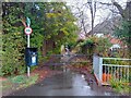
Calvert Walk
A footpath between the corner of Beech Ride and Orchard Gate, and Wellington Road.
The footpath is called Calvert Walk as underneath it (and under most of the Longdown Lodge Estate) is a culvert or underwater stream, which appears in ditches on Wellington Road (which can be seen emerging to the right with the railings and brickwork). During heavy rainfall such as the day this photograph was taken, the lower half of the footpath becomes part of the stream, as water spurts from below.
Image: © Oscar Taylor
Taken: 31 Mar 2023
0.02 miles
3
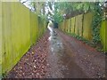
Flooded Calvert Walk
Flooding on Calvert Walk - a footpath between the corner of Beech Ride and Orchard Gate, and Wellington Road - following heavy rain.
The footpath is called Calvert Walk as underneath it (and under most of the Longdown Lodge Estate) is a culvert or underwater stream, which appears in ditches on Wellington Road. During heavy rainfall such as the day this photograph was taken, the lower half of the footpath becomes part of the stream, as water spurts from below the path and rushes down to Wellington Road.
Image: © Oscar Taylor
Taken: 31 Mar 2023
0.02 miles
4
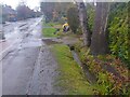
Stream on Wellington Road after heavy rain
The stream that emerges on Wellington Road after travelling down Calvert Walk Image It runs along a drainage ditch until it disappears a few metres further east. The stream then continues underground until it reaches Blackwater River further south.
Image: © Oscar Taylor
Taken: 31 Mar 2023
0.02 miles
5
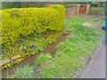
Stream on Wellington Road after heavy rain
The stream that emerges on Wellington Road after travelling down Calvert Walk Image It runs along a drainage ditch until it disappears a few metres further east. The stream then continues underground until it reaches Blackwater River further south.
Image: © Oscar Taylor
Taken: 31 Mar 2023
0.03 miles
6
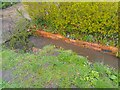
Stream on Wellington Road after heavy rain
The stream that emerges on Wellington Road after travelling down Calvert Walk Image It runs along a drainage ditch until it disappears a few metres further east. The stream then continues underground until it reaches Blackwater River further south.
For a view of the same location before an hour's heavy rain, see Image
Image: © Oscar Taylor
Taken: 31 Mar 2023
0.03 miles
7
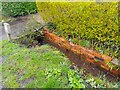
Stream on Wellington Road
The stream that emerges on Wellington Road after travelling down Calvert Walk Image It runs along a drainage ditch until it disappears a few metres further east. The stream then continues underground until it reaches Blackwater River further south.
For a view of the same location after an hour's heavy rain, see Image
Image: © Oscar Taylor
Taken: 31 Mar 2023
0.03 miles
8
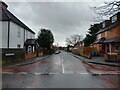
Albion Road
A road between Wellington Road and Yorktown Road. On the road is Uplands Primary School.
Image: © Oscar Taylor
Taken: 31 Mar 2023
0.04 miles
9
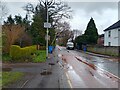
Wellington Road
A road with speed humps, between Crowthorne Road and Yorktown Road in Sandhurst. The road has a one way section at the Crowthorne Road end to prevent it being used as a bypass of the high street. There are many roads leading to Yorktown Road off the road, such as the way indicated to Uplands Primary School, down Albion Road.
Image: © Oscar Taylor
Taken: 31 Mar 2023
0.05 miles
10
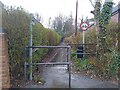
Calvert Walk
A footpath between the corner of Beech Ride and Orchard Gate, and Wellington Road.
The footpath is called Calvert Walk as underneath it (and under most of the Longdown Lodge Estate) is a culvert or underwater stream, which appears in ditches on Wellington Road. During heavy rainfall such as the day this photograph was taken, the lower half of the footpath becomes part of the stream, as water spurts from below.
Image: © Oscar Taylor
Taken: 31 Mar 2023
0.05 miles