Calvert Walk
Introduction
The photograph on this page of Calvert Walk by Oscar Taylor as part of the Geograph project.
The Geograph project started in 2005 with the aim of publishing, organising and preserving representative images for every square kilometre of Great Britain, Ireland and the Isle of Man.

There are currently over 7.5m images from over 14,400 individuals and you can help contribute to the project by visiting https://www.geograph.org.uk
Calvert Walk
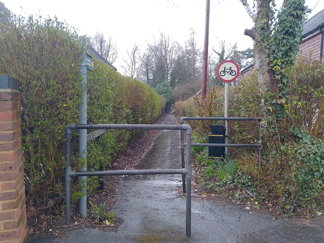
Image: © Oscar Taylor Taken: 31 Mar 2023
A footpath between the corner of Beech Ride and Orchard Gate, and Wellington Road. The footpath is called Calvert Walk as underneath it (and under most of the Longdown Lodge Estate) is a culvert or underwater stream, which appears in ditches on Wellington Road. During heavy rainfall such as the day this photograph was taken, the lower half of the footpath becomes part of the stream, as water spurts from below.
Images are licensed for reuse under creativecommons.org/licenses/by-sa/2.0
Image Location
Latitude
51.349911
Longitude
-0.797218