IMAGES TAKEN NEAR TO
Sotherington Lane, ALTON, GU34 3LP
Introduction
This page details the photographs taken nearby to Sotherington Lane, GU34 3LP by members of the Geograph project.
The Geograph project started in 2005 with the aim of publishing, organising and preserving representative images for every square kilometre of Great Britain, Ireland and the Isle of Man.

There are currently over 7.5m images from over14,400 individuals and you can help contribute to the project by visiting https://www.geograph.org.uk
Image Map
Images are licensed for reuse under creativecommons.org/licenses/by-sa/2.0
Notes
- Clicking on the map will re-center to the selected point.
- The higher the marker number, the further away the image location is from the centre of the postcode.
Image Listing (22 Images Found)
Images are licensed for reuse under creativecommons.org/licenses/by-sa/2.0
Image
Details
Distance
1
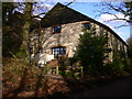
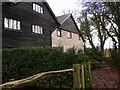
"The Kiln" near Selborne (2)
On my 1995 OS Pathfinder these buildings are named Sotherington Farm.
Image: © Shazz
Taken: 12 Feb 2011
0.01 miles
3
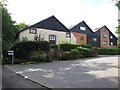
"The Kiln" near Selborne (1)
On my 1995 OS Pathfinder these buildings are named Sotherington Farm.
Image: © Shazz
Taken: 12 Feb 2011
0.02 miles
5
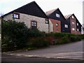
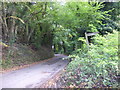
Byway reaches road by "The Kiln"
On my 1995 OS Pathfinder these buildings are named Sotherington Farm.
Image: © Shazz
Taken: 12 Feb 2011
0.06 miles
6
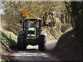
Hedge Trimming on Sotherington Lane
Necessary and seasonal activity in a country lane east of Selborne.
Image: © Colin Smith
Taken: 6 Mar 2012
0.06 miles
7
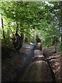
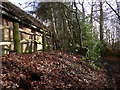
Rutted byway north of Sotherington Lane
Running through farmland east of Selborne.
Image: © Stefan Czapski
Taken: 8 Jul 2017
0.07 miles
8
Trim and Tidy
High hedge of trees, about 12-15 feet tall, on Sotherington Lane receiving a haircut from a trimmer on a tractor.
Image: © Colin Smith
Taken: 6 Mar 2012
0.08 miles
9
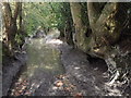
Fit for Amphibious Traffic
This wide byway by Sotherington Farm is now very badly rutted and surface water fills much of the slowly draining clay terrain. Walkers have found refuge by making a parallel path on the bank but even up here motor cyclists have caused further erosion.
Image: © Colin Smith
Taken: 6 Mar 2012
0.09 miles
10
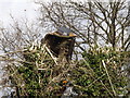
Wandering westwards along the Bashire (15)
Two ways to Selborne
1) By road to the B3006, turn right
2) Across the fields by footpath to Honey Lane
(Running total: 367 B points)
Image: © Basher Eyre
Taken: 19 Oct 2016
0.09 miles