IMAGES TAKEN NEAR TO
Mill Lane, PETERSFIELD, GU32 2DJ
Introduction
This page details the photographs taken nearby to Mill Lane, GU32 2DJ by members of the Geograph project.
The Geograph project started in 2005 with the aim of publishing, organising and preserving representative images for every square kilometre of Great Britain, Ireland and the Isle of Man.

There are currently over 7.5m images from over14,400 individuals and you can help contribute to the project by visiting https://www.geograph.org.uk
Image Map
Images are licensed for reuse under creativecommons.org/licenses/by-sa/2.0
Notes
- Clicking on the map will re-center to the selected point.
- The higher the marker number, the further away the image location is from the centre of the postcode.
Image Listing (31 Images Found)
Images are licensed for reuse under creativecommons.org/licenses/by-sa/2.0
Image
Details
Distance
1
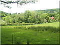
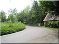
Looking back from Northfield Wood towards Oakhurst Farm
Image: © Basher Eyre
Taken: 23 May 2009
0.09 miles
2
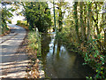
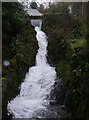
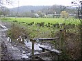
Stream by Mill Lane, Steep
The mill concerned, Steep Mill, a corn mill, used this stream and was upstream on the other side of the lane. There is now a picturesque waterfall where the mill used to be.
Image: © Robin Webster
Taken: 26 Nov 2013
0.10 miles
3
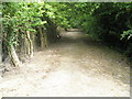
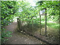
The Hangers Way just before Island Farm Lane
Image: © Basher Eyre
Taken: 23 May 2009
0.10 miles
4
Torrent
An otherwise gentle stream flowing off the hangars, is held back by a dam at the top of the picture and further constrained by a narrow gap to produce this torrent, particularly after the heavy rain in the days before this picture was taken.
Image: © Graham Horn
Taken: 4 Mar 2007
0.11 miles
8
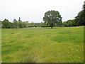
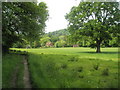
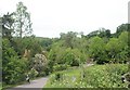
Towards Ashford Chase
Emerging from woodland north of Steep, the Hangars Way (a Hampshire County Council path from Queen Elizabeth Country Park to Alton) crosses a piece of farmland, with the hangars after which the path is named now visible in the distance.
Image: © Graham Horn
Taken: 4 Mar 2007
0.13 miles
9
Lone LDWA competitor in Island Farm Lane
For more details of the Wessex 100 race he was in, see http://www.wessex100.org.uk/
Image: © Basher Eyre
Taken: 23 May 2009
0.13 miles