IMAGES TAKEN NEAR TO
Northchapel, PETWORTH, GU28 9LH
Introduction
This page details the photographs taken nearby to GU28 9LH by members of the Geograph project.
The Geograph project started in 2005 with the aim of publishing, organising and preserving representative images for every square kilometre of Great Britain, Ireland and the Isle of Man.

There are currently over 7.5m images from over14,400 individuals and you can help contribute to the project by visiting https://www.geograph.org.uk
Image Map
Images are licensed for reuse under creativecommons.org/licenses/by-sa/2.0
Notes
- Clicking on the map will re-center to the selected point.
- The higher the marker number, the further away the image location is from the centre of the postcode.
Image Listing (15 Images Found)
Images are licensed for reuse under creativecommons.org/licenses/by-sa/2.0
Image
Details
Distance
1
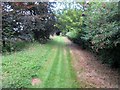
Footpath adjacent to Common Piece
Public footpath 582 to School House Farm. The actual path differs from the way shown on the OS Explorer map.
Image: © Peter Holmes
Taken: 12 Aug 2017
0.05 miles
2
Footbridge over drainage ditch
Public footpath 583 from Streel's Lane to Streel's Lane. The drain eventually flows into the River Kird.
Image: © Peter Holmes
Taken: 12 Aug 2017
0.05 miles
3
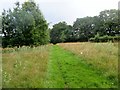
Mowed footpath
Public footpath 583 from Streel's Lane to Streel's Lane.
Image: © Peter Holmes
Taken: 12 Aug 2017
0.07 miles
4
Footpath adjacent to vineyard
Public footpath 582 to School House Farm. The actual path differs from the way shown on the OS Explorer map.
Image: © Peter Holmes
Taken: 12 Aug 2017
0.07 miles
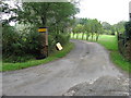
5
Footpath to Ebernoe
Public footpath 583.
Image: © Peter Holmes
Taken: 12 Aug 2017
0.07 miles
7
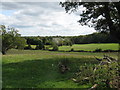
View SE towards overgrown Vineyard near Common Piece
Image: © Dave Spicer
Taken: 5 Sep 2009
0.09 miles
8
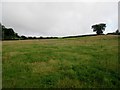
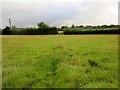
Undefined footpath
Public footpath 582 to School House Farm crosses this field towards the lone tree on the horizon.
Image: © Peter Holmes
Taken: 12 Aug 2017
0.11 miles
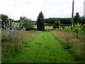
9
Footpath crossing field
Public footpath 583 from Streel's Lane to Streel's Lane.
Image: © Peter Holmes
Taken: 12 Aug 2017
0.12 miles
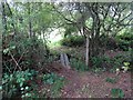
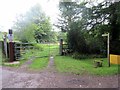
10
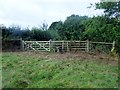
Gate and stile
Public footpath 583 from Streel's Lane to Streel's Lane.
Image: © Peter Holmes
Taken: 12 Aug 2017
0.12 miles