IMAGES TAKEN NEAR TO
Graffham, PETWORTH, GU28 0NU
Introduction
This page details the photographs taken nearby to GU28 0NU by members of the Geograph project.
The Geograph project started in 2005 with the aim of publishing, organising and preserving representative images for every square kilometre of Great Britain, Ireland and the Isle of Man.

There are currently over 7.5m images from over14,400 individuals and you can help contribute to the project by visiting https://www.geograph.org.uk
Image Map
Images are licensed for reuse under creativecommons.org/licenses/by-sa/2.0
Notes
- Clicking on the map will re-center to the selected point.
- The higher the marker number, the further away the image location is from the centre of the postcode.
Image Listing (14 Images Found)
Images are licensed for reuse under creativecommons.org/licenses/by-sa/2.0
Image
Details
Distance
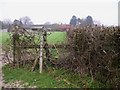
1
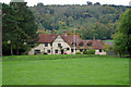
Hayland Farm
The backdrop is the South Downs, which are continuously wooded for some miles in this area.
Image: © Robin Webster
Taken: 13 Oct 2010
0.02 miles
2
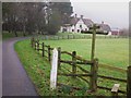
Farmhouse at Hayland Farm seen from crosspaths
Image: © Shazz
Taken: 17 Feb 2011
0.03 miles
4
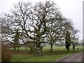
Oak with snowdrops at Hayland Farm
Next to the tree trunk is a pole carrying a cable.
Image: © Shazz
Taken: 17 Feb 2011
0.07 miles
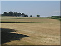
7
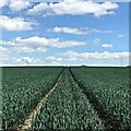
Path heading east - south of Hales Copse
This is a sort of dual carriageway for walkers. Compare this path with Image] which runs through the same crop, about 400 metres to the south. The latter is a bridleway, whereas this is a public footpath. Horses clearly need a wider single carriageway!
Image: © Ian Hawfinch
Taken: 5 Jun 2021
0.15 miles
8
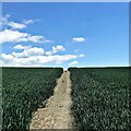
Bridleway heading ESE - SW of Hayland Farm
Compare this path with Image] which runs through the same crop, about 400 metres to the north. The latter is a public footpath, whereas this is a bridleway. Horses clearly need a wider single carriageway!
Image: © Ian Hawfinch
Taken: 5 Jun 2021
0.15 miles
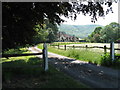
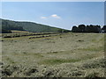
9
Silage and hay fields south of Woodcote Farm
Image: © Dave Spicer
Taken: 26 Jun 2010
0.16 miles
10
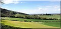
View WNW along the foot of the South Downs
Image: © Ian Hawfinch
Taken: 27 Apr 2021
0.16 miles