IMAGES TAKEN NEAR TO
Sapperton, CIRENCESTER, GL7 6LR
Introduction
This page details the photographs taken nearby to GL7 6LR by members of the Geograph project.
The Geograph project started in 2005 with the aim of publishing, organising and preserving representative images for every square kilometre of Great Britain, Ireland and the Isle of Man.

There are currently over 7.5m images from over14,400 individuals and you can help contribute to the project by visiting https://www.geograph.org.uk
Image Map
Images are licensed for reuse under creativecommons.org/licenses/by-sa/2.0
Notes
- Clicking on the map will re-center to the selected point.
- The higher the marker number, the further away the image location is from the centre of the postcode.
Image Listing (20 Images Found)
Images are licensed for reuse under creativecommons.org/licenses/by-sa/2.0
Image
Details
Distance
2
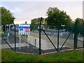
Sapperton 3827 Unodourised Gas Installation
This is owned by the Gas National Grid and is situated right next to broad ride one of the original rides laid out for the Lord Bathurst's Cirencester park. The trees in the background are on the ride which is dead straight for five miles.
Image: © Nigel Mykura
Taken: 7 Oct 2007
0.06 miles
3
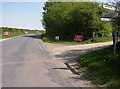
Warning - lots of signs ahead
As a driver you had better be going pretty slowly to read and digest all of these. I never did find out what they were doing.
Image: © Graham Horn
Taken: 30 Apr 2007
0.08 miles
6
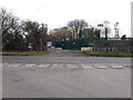
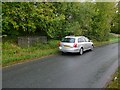
Emmerson Lane
Looking south-west down Emmerson Lane from the Gas Plant. The small railed area on the left contains an Ordnance Survey Fundamental Bench Mark.
Image: © Peter Wood
Taken: 12 Mar 2013
0.11 miles
7
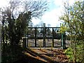
Sapperton Fundamental Bench Mark
This fence encloses the bench mark on the south side of the road a few metres just north of Broad Ride. See also Image
Image: © Nigel Mykura
Taken: 7 Oct 2011
0.12 miles
8
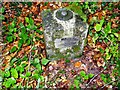
Sapperton Fundamental Bench Mark
This shows the external above ground part of the bench mark. Most of it is hidden in a chamber underneath. The height above Newlyn datum sea level is marked on the top as 594.88 ft.
See also Image
Image: © Nigel Mykura
Taken: 7 Oct 2011
0.13 miles
9
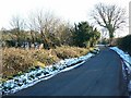
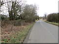
Minor road south of Sapperton
The road culminates in a 'T' junction just visible in the distance.
Image: © Brian Robert Marshall
Taken: 6 Jan 2009
0.13 miles
10
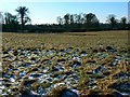
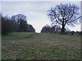
Farmland south of Sapperton
Rather bleak-looking pasture brightened somewhat by the low winter sun.
Image: © Brian Robert Marshall
Taken: 6 Jan 2009
0.19 miles