Sapperton Fundamental Bench Mark
Introduction
The photograph on this page of Sapperton Fundamental Bench Mark by Nigel Mykura as part of the Geograph project.
The Geograph project started in 2005 with the aim of publishing, organising and preserving representative images for every square kilometre of Great Britain, Ireland and the Isle of Man.

There are currently over 7.5m images from over 14,400 individuals and you can help contribute to the project by visiting https://www.geograph.org.uk
Sapperton Fundamental Bench Mark
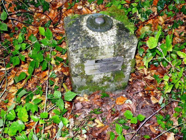
Image: © Nigel Mykura Taken: 7 Oct 2011
This shows the external above ground part of the bench mark. Most of it is hidden in a chamber underneath. The height above Newlyn datum sea level is marked on the top as 594.88 ft. See also Image
Images are licensed for reuse under creativecommons.org/licenses/by-sa/2.0
Image Location
Latitude
51.724347
Longitude
-2.073353