
IMAGES TAKEN NEAR TO
Bittern Close, CIRENCESTER, GL7 5WN
Introduction
This page details the photographs taken nearby to Bittern Close, GL7 5WN by members of the Geograph project.
The Geograph project started in 2005 with the aim of publishing, organising and preserving representative images for every square kilometre of Great Britain, Ireland and the Isle of Man.

There are currently over 7.5m images from over14,400 individuals and you can help contribute to the project by visiting https://www.geograph.org.uk
Image Map
Images are licensed for reuse under creativecommons.org/licenses/by-sa/2.0
Notes
- Clicking on the map will re-center to the selected point.
- The higher the marker number, the further away the image location is from the centre of the postcode.
Image Listing (12 Images Found)
Images are licensed for reuse under creativecommons.org/licenses/by-sa/2.0
Image
Details
Distance
1
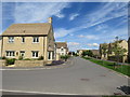
Cerney on the Water, South Cerney
Cerney on the Water is a recently-built housing development in the village of South Cerney, in Gloucestershire. The houses are clad with Cotswold stone.
Image: © Malc McDonald
Taken: 12 Jul 2020
0.12 miles
2
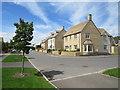
Cerney on the Water, South Cerney
Cerney on the Water is a recently-completed housing development in the village of South Cerney in Gloucestershire.
Image: © Malc McDonald
Taken: 12 Jul 2020
0.12 miles
3
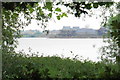
New development near South Cerney
There is an expansion of residential facilities on the south side of South Cerney.
Image: © Bill Boaden
Taken: 26 May 2018
0.14 miles
4

Cerney on the Water, South Cerney
Cerney on the Water is a newly-built housing development in the village of South Cerney, in Gloucestershire.
Image: © Malc McDonald
Taken: 12 Jul 2020
0.15 miles
5

Heron in Sudeley Drive, South Cerney
I took this whilst waiting for Naomi to give what teeth I have left their bi-annual scale and polish. This fine specimen of Ardea cinerea remained on the chimney top for quite a few minutes. As can be seen this was a fine day but quite cold so maybe the bird was keeping its toes warm.
Image: © Brian Robert Marshall
Taken: 15 Nov 2010
0.17 miles
6
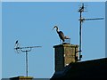
Heron and starling in Sudeley Drive, South Cerney
The starling is the one on the left.
Image: © Brian Robert Marshall
Taken: 15 Nov 2010
0.17 miles
7
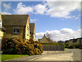
Sudeley Drive, South Cerney
Taken while waiting to see my dentist. Just visible in the sky in the top centre is an aircraft condensation trail, the first I'd seen since last week when UK airspace was closed following the eruption of the Eyjafjallajökull volcano in Iceland a few days earlier.
Image: © Brian Robert Marshall
Taken: 20 Apr 2010
0.20 miles
8
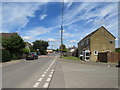
Broadway Lane, South Cerney
Broadway lane in the village of South Cerney, in Gloucestershire.
Image: © Malc McDonald
Taken: 12 Jul 2020
0.22 miles
9
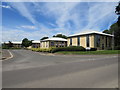
Lakeside Business Park, South Cerney
Lakeside Business Park in the village of South Cerney, in Gloucestershire.
Image: © Malc McDonald
Taken: 12 Jul 2020
0.24 miles
10
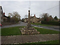
Wayside Cross, South Cerney
South Cerney Cross, old shaft, base & steps in a new cross. Benchmark at the base representing 90.2 m ASL.
Grade II listed monument see https://historicengland.org.uk/listing/the-list/list-entry/1154162
Milestone Society National ID: GLCO_SOU01
Image: © Mr Red
Taken: 28 Nov 2021
0.24 miles