
IMAGES TAKEN NEAR TO
Newmarket Road, STROUD, GL6 0DQ
Introduction
This page details the photographs taken nearby to Newmarket Road, GL6 0DQ by members of the Geograph project.
The Geograph project started in 2005 with the aim of publishing, organising and preserving representative images for every square kilometre of Great Britain, Ireland and the Isle of Man.

There are currently over 7.5m images from over14,400 individuals and you can help contribute to the project by visiting https://www.geograph.org.uk
Image Map
Images are licensed for reuse under creativecommons.org/licenses/by-sa/2.0
Notes
- Clicking on the map will re-center to the selected point.
- The higher the marker number, the further away the image location is from the centre of the postcode.
Image Listing (99 Images Found)
Images are licensed for reuse under creativecommons.org/licenses/by-sa/2.0
Image
Details
Distance
1
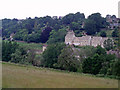
New development in Worley
A row of new houses, built in the traditional Cotswold stone, in the Worley area of Nailsworth. The view is across a deep valley which carries Miry Brook.
Image: © Sharon Loxton
Taken: 28 Jun 2006
0.09 miles
2
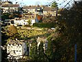
Worley, Nailsworth
Nailsworth lies at the confluence of several valleys. This view is across the valley leading in from the west. The houses on the far side probably date from the 1960s or 70s.
Image: © Brian Robert Marshall
Taken: 11 Nov 2008
0.11 miles
3
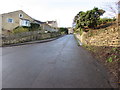
Steep ascent, Chestnut Hill, Nailsworth
Chestnut Hill ascends towards the Fewster Road junction.
Image: © Jaggery
Taken: 20 Dec 2015
0.12 miles
4

Stone Stile, Nailsworth
Concrete squeeze stile up steps from Walkley Lane on Gloucestershire footpath ZNA20 looking SW. The view NE toward the road is Image
Image: © Mr Red
Taken: 14 Jan 2022
0.13 miles
5

Stone Stile, Nailsworth
Concrete squeeze stile up steps from Walkley Lane on Gloucestershire footpath ZNA20 looking NE to the lane. The view SW is Image
Image: © Mr Red
Taken: 14 Jan 2022
0.13 miles
6

Stone Stile, Nailsworth
In the Newmarket area of Nailsworth, next to the Nailsworth Donkey Sanctuary. At the exit of Gloucestershire footpath ZNA16 onto Newmarket Road.
Image: © Mr Red
Taken: 14 Jan 2022
0.13 miles
7
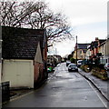
West along Newmarket Road, Nailsworth
Viewed from Cossack Square.
A nearby sign shows that Newmarket Road leads to Lower Newmarket Road and Higher Newmarket Road.
Image: © Jaggery
Taken: 20 Dec 2015
0.13 miles
8
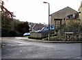
Corner of Chestnut Close and Chestnut Hill, Nailsworth
Viewed from the corner of Orchard Mead.
Image: © Jaggery
Taken: 20 Dec 2015
0.14 miles
9
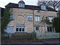
ex Toll House, Horsley Road, Nailsworth
At the junction of Pike Lane with Horsley Road, which was a turnpike from Nailsworth to Wotton under Edge and Dursley. This section of Horsley Road to the junction with the Old Bristol Road was superseded but the then "new" Old Bristol Road when it was made in 1822. There is a Toll House further West of that junction which would have served from that time on. Served the Coldharbour Turnpike Trust.
https://www.geograph.org.uk/photo/7435525
Milestone Society National ID: GL.NAI04
Image: © Mr Red
Taken: 22 Nov 2022
0.14 miles
10
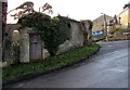
Overgrown derelict building on a Nailsworth corner
On the corner of Chestnut Hill and Chestnut Close.
Image: © Jaggery
Taken: 20 Dec 2015
0.15 miles