ex Toll House, Horsley Road, Nailsworth
Introduction
The photograph on this page of ex Toll House, Horsley Road, Nailsworth by Mr Red as part of the Geograph project.
The Geograph project started in 2005 with the aim of publishing, organising and preserving representative images for every square kilometre of Great Britain, Ireland and the Isle of Man.

There are currently over 7.5m images from over 14,400 individuals and you can help contribute to the project by visiting https://www.geograph.org.uk
ex Toll House, Horsley Road, Nailsworth
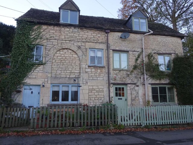
Image: © Mr Red Taken: 22 Nov 2022
At the junction of Pike Lane with Horsley Road, which was a turnpike from Nailsworth to Wotton under Edge and Dursley. This section of Horsley Road to the junction with the Old Bristol Road was superseded but the then "new" Old Bristol Road when it was made in 1822. There is a Toll House further West of that junction which would have served from that time on. Served the Coldharbour Turnpike Trust. https://www.geograph.org.uk/photo/7435525 Milestone Society National ID: GL.NAI04
Images are licensed for reuse under creativecommons.org/licenses/by-sa/2.0
Image Location
Latitude
51.69224
Longitude
-2.222847