
IMAGES TAKEN NEAR TO
Ballards Close, CHIPPING CAMPDEN, GL55 6TN
Introduction
This page details the photographs taken nearby to Ballards Close, GL55 6TN by members of the Geograph project.
The Geograph project started in 2005 with the aim of publishing, organising and preserving representative images for every square kilometre of Great Britain, Ireland and the Isle of Man.

There are currently over 7.5m images from over14,400 individuals and you can help contribute to the project by visiting https://www.geograph.org.uk
Image Map
Images are licensed for reuse under creativecommons.org/licenses/by-sa/2.0
Notes
- Clicking on the map will re-center to the selected point.
- The higher the marker number, the further away the image location is from the centre of the postcode.
Image Listing (53 Images Found)
Images are licensed for reuse under creativecommons.org/licenses/by-sa/2.0
Image
Details
Distance
1
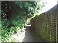
Village path
The footpath runs from High Street to St Lawrence's church.
Image: © Michael Dibb
Taken: 10 Apr 2011
0.03 miles
2
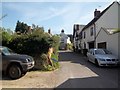
Path to the church
From High Street, this path leads to the parish church of St Lawrence.
Image: © Michael Dibb
Taken: 10 Apr 2011
0.04 miles
3
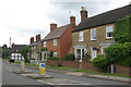
High Street, Mickleton
This was once the A46 between Stratford upon Avon and Cheltenham; it is much quieter now that the A46 takes a more northerly route, leaving Mickleton to slumber on the B4632.
Image: © Stephen McKay
Taken: 27 May 2009
0.05 miles
4
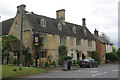
The King's Arms, Mickleton
The King's Arms is a village pub and restaurant on what was once the A46 between Stratford upon Avon and Cheltenham; the road has now been downgraded to become the B4632 making Mickleton something of a quiet backwater - but the pub seems to be thriving.
Image: © Stephen McKay
Taken: 27 May 2009
0.06 miles
5
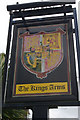
The King's Arms, Mickleton
Eye-catching and rather splendid sign outside the King's Arms.
Image: © Stephen McKay
Taken: 27 May 2009
0.06 miles
6
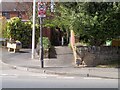
Path to Chapel Lane
From High Street, this footpath leads to Chapel Lane.
Image: © Michael Dibb
Taken: 10 Apr 2011
0.07 miles
7
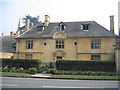
Mickelton
This fine Queen Anne House, built in Cotswold ashlar, is in the High Street near Mickleton Manor.
Image: © David Stowell
Taken: 27 Mar 2007
0.09 miles
8
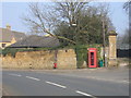
Fortress Mickelton
The bend in the High Street by the gates to Mickelton Manor. Notices the 3 holes near the top of the wall to the left of the 'phone kiosk. These were put in by the Home Guard during WWII to defend the village against invasion!
Image: © David Stowell
Taken: 27 Mar 2007
0.09 miles
9
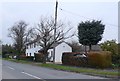
High St, Mickleton
Taken from close to the junction with Ballards Close, looking south west along the High Street. The houses on the right are just close to Pound Lane.
Image: © Nigel Mykura
Taken: 20 Feb 2011
0.09 miles
10
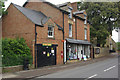
Mickleton Post Office
Post office and general store on the B4632.
Image: © Stephen McKay
Taken: 27 May 2009
0.09 miles