IMAGES TAKEN NEAR TO
Stow Road, CHELTENHAM, GL54 2HN
Introduction
This page details the photographs taken nearby to Stow Road, GL54 2HN by members of the Geograph project.
The Geograph project started in 2005 with the aim of publishing, organising and preserving representative images for every square kilometre of Great Britain, Ireland and the Isle of Man.

There are currently over 7.5m images from over14,400 individuals and you can help contribute to the project by visiting https://www.geograph.org.uk
Image Map
Images are licensed for reuse under creativecommons.org/licenses/by-sa/2.0
Notes
- Clicking on the map will re-center to the selected point.
- The higher the marker number, the further away the image location is from the centre of the postcode.
Image Listing (15 Images Found)
Images are licensed for reuse under creativecommons.org/licenses/by-sa/2.0
Image
Details
Distance
1
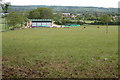
New farm building, Bourton-on-the-Water
The new farm building in the corner of the field is not on the OS map. In the background is Bourton-on-the-Water
Image: © Philip Halling
Taken: 29 May 2006
0.07 miles
2
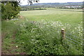
The Monarch's Way
In the background is Icomb Hill.
Image: © Philip Halling
Taken: 29 May 2006
0.10 miles
3
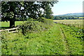
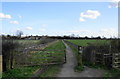
Monarch's Way towards Lower Slaughter
Many of the footpaths around Bourton-on-the-Water are part of long distance paths. The Monarch's Way from Worcester to Shoreham comes up this path.
Image: © Graham Horn
Taken: 9 Sep 2012
0.12 miles
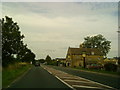
5
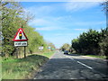
A429 Fosse Way Turning For Bourton-on-the-Water
Image: © Roy Hughes
Taken: 25 Mar 2017
0.14 miles
6
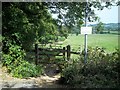
The Wardens' Way [2]
Here the path meets the minor road.
Image: © Michael Dibb
Taken: 2 Sep 2010
0.15 miles
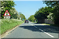
7
Path approaching the Fosse Way
The non-tourist end of Bourton-on-the-Water is the other side of the road, the A429
Image: © Bill Boaden
Taken: 8 Apr 2010
0.16 miles
8
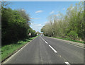
A429 heading north
The Roman Foss Way. The lights are for one of the roads into Bourton-on-the-Water, which lies very largely to the right of the Roman route.
Image: © Robin Webster
Taken: 30 May 2021
0.17 miles
9
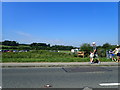
Walking to Bourton-on-the-Water from an out-of-town car park
Extra parking laid on for the Bank Holiday off the A429
Image: © Eirian Evans
Taken: 26 Aug 2019
0.17 miles