1
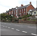
Houses above Bath Road, Lightpill
Viewed across the A46 Bath Road from the entrance http://www.geograph.org.uk/photo/4709211 to Stroud Enterprise Centre.
Image: © Jaggery
Taken: 18 Oct 2015
0.03 miles
2
Kitesnest Lane, Lightpill
Ascending from the A46 Bath Road.
Image: © Jaggery
Taken: 18 Oct 2015
0.04 miles
3
Bath Road houses, Lightpill
Near the Kitesnest Lane junction.
Image: © Jaggery
Taken: 18 Oct 2015
0.04 miles
4
Revive in Stroud
Hair and beauty salon at 112 Bath Road.
Image: © Jaggery
Taken: 18 Oct 2015
0.05 miles
5
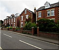
Houses on the corner of Kitesnest Lane and Bath Road, Lightpill
Lightpill is part of Rodborough civil parish in the district of Stroud,
and is part of the Stroud urban area along with Stroud and Cainscross.
Image: © Jaggery
Taken: 18 Oct 2015
0.06 miles
6
Front Runners, Stroud
Car sales business in Bath Road Garage, Lightpill, Stroud.
Image: © Jaggery
Taken: 18 Oct 2015
0.06 miles
7
Stroud Enterprise Centre nameboard
On the right here, http://www.geograph.org.uk/photo/4709211 viewed in mid-October 2015.
Image: © Jaggery
Taken: 18 Oct 2015
0.06 miles
8
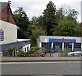
Bath Road Motor Services and MOT Centre, Stroud
Set below the west side of the A46 Bath Road.
A blue background does not help the conspicuousness of the red letters.
Image: © Jaggery
Taken: 18 Oct 2015
0.06 miles
9
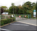
Entrance to Stroud Enterprise Centre
From the A46 Bath Road. The entrance gates are locked on a Sunday.
Image: © Jaggery
Taken: 18 Oct 2015
0.06 miles
10
Bath Road direction sign, Lightpill
Facing the Kitesnest Lane junction. Left along the A46 Bath Road for Nailsworth and Bath, right for Stroud. Lightpill is part of Rodborough civil parish in the district of Stroud, and is part of the Stroud urban area along with Stroud and Cainscross.
Image: © Jaggery
Taken: 18 Oct 2015
0.07 miles


