
IMAGES TAKEN NEAR TO
Phoenix Trading Estate, London Road, STROUD, GL5 2BX
Introduction
This page details the photographs taken nearby to Phoenix Trading Estate, London Road, GL5 2BX by members of the Geograph project.
The Geograph project started in 2005 with the aim of publishing, organising and preserving representative images for every square kilometre of Great Britain, Ireland and the Isle of Man.

There are currently over 7.5m images from over14,400 individuals and you can help contribute to the project by visiting https://www.geograph.org.uk
Image Map
Images are licensed for reuse under creativecommons.org/licenses/by-sa/2.0
Notes
- Clicking on the map will re-center to the selected point.
- The higher the marker number, the further away the image location is from the centre of the postcode.
Image Listing (105 Images Found)
Images are licensed for reuse under creativecommons.org/licenses/by-sa/2.0
Image
Details
Distance
1

The Golden Valley
Thrupp and the Golden Valley viewed from Rodborough.
Image: © Philip Halling
Taken: 11 Oct 2014
0.01 miles
2
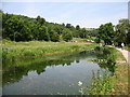
The Thames and Severn Canal, looking downstream
A stretch with plenty of water, though not yet navigable.
Image: © David Purchase
Taken: 21 Jun 2017
0.03 miles

5
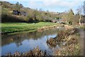
First Great Western train and canal
A First Great Western train reflected in the Thames and Severn Canal near Bagpath.
Image: © Philip Halling
Taken: 30 Jan 2016
0.06 miles
6
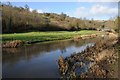
Thames and Severn Canal
Thames and Severn Canal near Bagpath. A First Great Western train is just visible on the railway line to the left.
Image: © Philip Halling
Taken: 30 Jan 2016
0.06 miles
7

Ham Mill, Thrupp
There has been a mill here since at least 1608. There have been grist, fulling and gig mills here. In 1825 the site was making cloth woven on power looms. From 1900 to 1954 the mill wove carpets and then until closure it spun carpet yarn for Carpets of Worth for weaving in Stourport. The site is now disused and waiting its fate. The Stourport factory has been flattened and the site is now being built on.
Image: © Chris Allen
Taken: 28 Apr 2012
0.07 miles
8
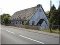
Thrupp (Glos) Tin Church
The grid reference is a bit of a guess as the modern map shows no church and the Geograph 1940s map is unclear but this spot appears to have a church symbol! Not long for this world it seems.
Image: © ChurchCrawler
Taken: Unknown
0.07 miles
9
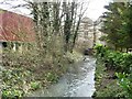
Ham Mill and its mill stream
Looking upstream from Ham Mill Lane. The watermill is part of a factory complex where carpets were made until 2000.
Image: © Christine Johnstone
Taken: 28 Mar 2016
0.07 miles
10
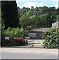
Southeast entrance to the former Ham Mill site, Thrupp
From the A419 London Road. The name on the red banner is Assael Architecture who are working with Stroud Corporation and CgMs Consulting on planning proposals for this former mill site to secure its appropriate regeneration and reuse.
Image: © Jaggery
Taken: 6 Sep 2015
0.08 miles