Thrupp (Glos) Tin Church
Introduction
The photograph on this page of Thrupp (Glos) Tin Church by ChurchCrawler as part of the Geograph project.
The Geograph project started in 2005 with the aim of publishing, organising and preserving representative images for every square kilometre of Great Britain, Ireland and the Isle of Man.

There are currently over 7.5m images from over 14,400 individuals and you can help contribute to the project by visiting https://www.geograph.org.uk
Thrupp (Glos) Tin Church
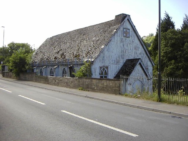
Image: © ChurchCrawler Taken: Unknown
The grid reference is a bit of a guess as the modern map shows no church and the Geograph 1940s map is unclear but this spot appears to have a church symbol! Not long for this world it seems.
Images are licensed for reuse under creativecommons.org/licenses/by-sa/2.0
Image Location
Latitude
51.726625
Longitude
-2.201632