
IMAGES TAKEN NEAR TO
London Road, STROUD, GL5 2BQ
Introduction
This page details the photographs taken nearby to London Road, GL5 2BQ by members of the Geograph project.
The Geograph project started in 2005 with the aim of publishing, organising and preserving representative images for every square kilometre of Great Britain, Ireland and the Isle of Man.

There are currently over 7.5m images from over14,400 individuals and you can help contribute to the project by visiting https://www.geograph.org.uk
Image Map
Images are licensed for reuse under creativecommons.org/licenses/by-sa/2.0
Notes
- Clicking on the map will re-center to the selected point.
- The higher the marker number, the further away the image location is from the centre of the postcode.
Image Listing (108 Images Found)
Images are licensed for reuse under creativecommons.org/licenses/by-sa/2.0
Image
Details
Distance
1
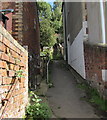
Path and steps to Middle Road, Thrupp
Ascending from the east side of the A419 London Road.
Image: © Jaggery
Taken: 6 Sep 2015
0.01 miles
2
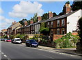
Osbourne Terrace, Thrupp
Row of houses on the east side of the A419 London Road.
Image: © Jaggery
Taken: 6 Sep 2015
0.02 miles
3
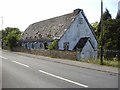
Thrupp (Glos) Tin Church
The grid reference is a bit of a guess as the modern map shows no church and the Geograph 1940s map is unclear but this spot appears to have a church symbol! Not long for this world it seems.
Image: © ChurchCrawler
Taken: Unknown
0.02 miles
4
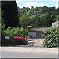
Southeast entrance to the former Ham Mill site, Thrupp
From the A419 London Road. The name on the red banner is Assael Architecture who are working with Stroud Corporation and CgMs Consulting on planning proposals for this former mill site to secure its appropriate regeneration and reuse.
Image: © Jaggery
Taken: 6 Sep 2015
0.03 miles
5
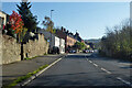
A419 London Road, Thrupp
Heading up the Golden Valley.
Image: © Robin Webster
Taken: 13 Nov 2022
0.04 miles
6
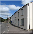
Phoenix House, London Road, Thrupp
Viewed in early September 2015 when the name on the windows of Phoenix House
on the right is Lyn Niblett Bookkeeping Services Limited.
Image: © Jaggery
Taken: 6 Sep 2015
0.06 miles
7
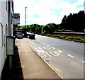
Phoenix House bus stop, Thrupp
The A419 London Road bus stop is alongside the office of Lyn Niblett Bookkeeping Services Limited. http://www.geograph.org.uk/photo/4656817
Image: © Jaggery
Taken: 6 Sep 2015
0.06 miles
8
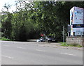
Kingfisher Business Park entrance, Thrupp
From the A419 London Road.
Image: © Jaggery
Taken: 6 Sep 2015
0.06 miles
9
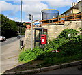
Queen Elizabeth II postbox on a Thrupp corner
The postbox and a grey phonebox are on the corner of Middle Road
and the A419 London Road in Thrupp, a village SE of Stroud, Gloucestershire.
Image: © Jaggery
Taken: 6 Sep 2015
0.06 miles
10
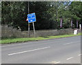
Information for lorry drivers sign, Thrupp
Alongside the A419 London Road. The next left turn ahead is into Kingfisher Business Park. http://www.geograph.org.uk/photo/4658411
Image: © Jaggery
Taken: 6 Sep 2015
0.06 miles