
IMAGES TAKEN NEAR TO
Pennine Road, CHELTENHAM, GL52 5HE
Introduction
This page details the photographs taken nearby to Pennine Road, GL52 5HE by members of the Geograph project.
The Geograph project started in 2005 with the aim of publishing, organising and preserving representative images for every square kilometre of Great Britain, Ireland and the Isle of Man.

There are currently over 7.5m images from over14,400 individuals and you can help contribute to the project by visiting https://www.geograph.org.uk
Image Map
Images are licensed for reuse under creativecommons.org/licenses/by-sa/2.0
Notes
- Clicking on the map will re-center to the selected point.
- The higher the marker number, the further away the image location is from the centre of the postcode.
Image Listing (42 Images Found)
Images are licensed for reuse under creativecommons.org/licenses/by-sa/2.0
Image
Details
Distance
1
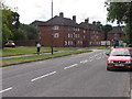
Priors Road, Cheltenham
The small apartment type blocks shown here are typical of the mid 1900's social housing which predominates in this square.
Image: © Terry Jacombs
Taken: 11 Aug 2005
0.09 miles
3
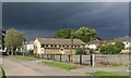
Holy Name Hall
A former church, which has recently been demolished to make way for new housing.
Image: © Helen Iwanczuk
Taken: 25 Aug 2018
0.10 miles
4
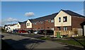
Ingleborough Mews, Pennine Road
A new housing development, has been built on the former Holy Name Hall site.
https://www.geograph.org.uk/photo/6430253
Image: © Helen Iwanczuk
Taken: 22 Feb 2021
0.12 miles
5
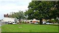
Glebe Road, Prestbury, 2
1930's council housing to cater for Cheltenham's expansion in the 20th century.
The Glebe was presumably a meadow with ribbon development along the outer road edges. The small estate seems to have quite rightly utilised the feature of pre-existing trees to form a cul-de-sac with a square turn-around.
Image: © Jonathan Billinger
Taken: 27 Aug 2014
0.12 miles
6
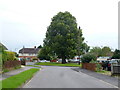
Glebe Road, Prestbury, 1
1930's council housing to cater for Cheltenham's expansion in the 20th century.
The Glebe was presumably a meadow with ribbon development along the outer road edges. The small estate seems to have quite rightly utilised the feature of pre-existing trees to form a cul-de-sac with a square turn-around.
Image: © Jonathan Billinger
Taken: 27 Aug 2014
0.12 miles
7
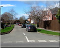
West along Chiltern Road, Prestbury
From Bouncers Lane, Chiltern Road leads to the B4075 Priors Road.
Image: © Jaggery
Taken: 17 Mar 2019
0.14 miles
8
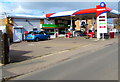
Bouncers Lane Service Station, Prestbury
Murco filling station and Londis shop.
Image: © Jaggery
Taken: 17 Mar 2019
0.15 miles
9
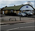
Prestbury Hall, Bouncers Lane, Prestbury
The hall is managed by Prestbury Hall Users Group, a registered charity.
Image: © Jaggery
Taken: 17 Mar 2019
0.15 miles
10
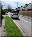
Glebe Road, Prestbury
Cul-de-sac on the south side of Prestbury Road.
Image: © Jaggery
Taken: 17 Mar 2019
0.15 miles