
IMAGES TAKEN NEAR TO
Folly Lane, STROUD, GL5 1SQ
Introduction
This page details the photographs taken nearby to Folly Lane, GL5 1SQ by members of the Geograph project.
The Geograph project started in 2005 with the aim of publishing, organising and preserving representative images for every square kilometre of Great Britain, Ireland and the Isle of Man.

There are currently over 7.5m images from over14,400 individuals and you can help contribute to the project by visiting https://www.geograph.org.uk
Image Map
Images are licensed for reuse under creativecommons.org/licenses/by-sa/2.0
Notes
- Clicking on the map will re-center to the selected point.
- The higher the marker number, the further away the image location is from the centre of the postcode.
Image Listing (114 Images Found)
Images are licensed for reuse under creativecommons.org/licenses/by-sa/2.0
Image
Details
Distance
1
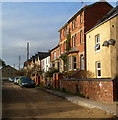
Uplands Road, Stroud
Uplands Road is a 100 metre long residential cul-de-sac. This view is from the Springfield Road end
near Uplands Post Office. http://www.geograph.org.uk/photo/3304447
Image: © Jaggery
Taken: 8 Jan 2012
0.09 miles
2
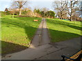
Path through the middle of Park Gardens, Stroud
Viewed from near the War Memorial. http://www.geograph.org.uk/photo/3303830
Image: © Jaggery
Taken: 8 Jan 2012
0.10 miles
3
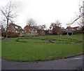
Parks park (Gardens) Stroud
Named after a local benefactor.
Image: © Steve Fareham
Taken: 9 Dec 2008
0.11 miles
4
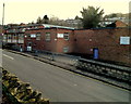
Stroud Instruments Ltd, Stroud
Located at 36-40 Slad Road, these are the premises of Stroud Instruments Ltd, manufacturers of instrumentation modules for process signal conditioning, monitoring, display and control.
On the right are the premises of Cottle Memorials, monumental masons.
Image: © Jaggery
Taken: 8 Jan 2012
0.12 miles
5
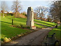
Park Gardens War Memorial, Stroud
When Park Gardens opened in October 1927, there was no War Memorial here.
This cenotaph dates from 1935, located at the southern (Slad Road) edge of Park Gardens.
Image: © Jaggery
Taken: 8 Jan 2012
0.12 miles
6
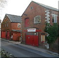
NorthSound Stroud
Premises at 26 Slad Road of NorthSound Ltd, pipe fitting, mechanical and electrical engineers.
Image: © Jaggery
Taken: 8 Jan 2012
0.13 miles
7
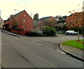
Streamside, Stroud
Streamside is an area of Salvation Army Housing Association Supporting Independent Living
flats alongside Slad Road.
Image: © Jaggery
Taken: 8 Jan 2012
0.13 miles
8
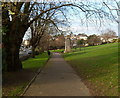
Path along the southern edge of Park Gardens, Stroud
Looking towards the War Memorial. http://www.geograph.org.uk/photo/3303830
Image: © Jaggery
Taken: 8 Jan 2012
0.13 miles
9
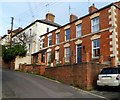
Uplands Cottages, Stroud
Uplands Cottages are the row of three dwellings in the foreground.
Viewed from the edge of Uplands Post Office http://www.geograph.org.uk/photo/3304447 looking across Springfield Road.
Image: © Jaggery
Taken: 8 Jan 2012
0.13 miles
10

Uplands, Stroud
Looking from Brickrow across the valley leading into Stroud from Slad. The church is All Saints', dating from 1907, on the north side of the valley. As a north-eastern suburb of the town, Uplands extends some way along this valley side.
Image: © Derek Harper
Taken: 19 Oct 2007
0.13 miles