Uplands, Stroud
Introduction
The photograph on this page of Uplands, Stroud by Derek Harper as part of the Geograph project.
The Geograph project started in 2005 with the aim of publishing, organising and preserving representative images for every square kilometre of Great Britain, Ireland and the Isle of Man.

There are currently over 7.5m images from over 14,400 individuals and you can help contribute to the project by visiting https://www.geograph.org.uk
Uplands, Stroud
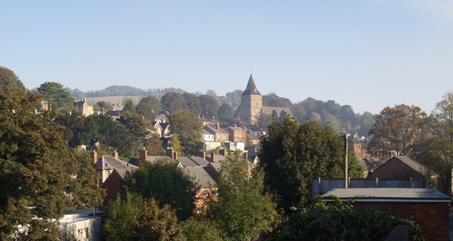
Image: © Derek Harper Taken: 19 Oct 2007
Looking from Brickrow across the valley leading into Stroud from Slad. The church is All Saints', dating from 1907, on the north side of the valley. As a north-eastern suburb of the town, Uplands extends some way along this valley side.
Images are licensed for reuse under creativecommons.org/licenses/by-sa/2.0
Image Location
Latitude
51.748006
Longitude
-2.211432