IMAGES TAKEN NEAR TO
Rookery Road, GLOUCESTER, GL3 1AU
Introduction
This page details the photographs taken nearby to Rookery Road, GL3 1AU by members of the Geograph project.
The Geograph project started in 2005 with the aim of publishing, organising and preserving representative images for every square kilometre of Great Britain, Ireland and the Isle of Man.

There are currently over 7.5m images from over14,400 individuals and you can help contribute to the project by visiting https://www.geograph.org.uk
Image Map (Loading...)


Getting Data...Please wait
Leaflet Map data © OpenStreetMap
Images are licensed for reuse under creativecommons.org/licenses/by-sa/2.0
Notes
- Clicking on the map will re-center to the selected point.
- The higher the marker number, the further away the image location is from the centre of the postcode.
Image Listing (13 Images Found)
Images are licensed for reuse under creativecommons.org/licenses/by-sa/2.0
Image
Details
Distance
2
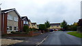
Bullfinch Way
Residential spur off Innsworth Lane.
Image: © Jonathan Billinger
Taken: 24 Oct 2016
0.14 miles
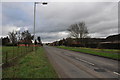
4
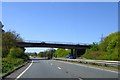
Innsworth Lane bridge
Road bridge linking Innsworth to the north and Longlevens
Image: © David Smith
Taken: 22 Apr 2015
0.17 miles
5
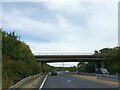
A40 Gloucester bypass Innsworth Lane overbridge
Image: © Roy Hughes
Taken: 24 Aug 2019
0.18 miles
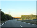
7
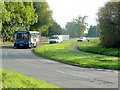
Bend in Innsworth Lane
A bus taking early Saturday morning shoppers into Gloucester city centre.
Image: © Jonathan Billinger
Taken: 18 Sep 2010
0.19 miles
8
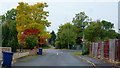
Junction of Innsworth Lane with Innsworth Lane
A road realignment leaves this anomaly, but the autumn colours are nice.
Image: © Jonathan Billinger
Taken: 24 Oct 2016
0.19 miles
9
Gloucester City Limits
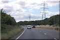
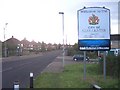
In the middle of an urban area, but close to the A40(T) northern relief road which may be the current limit of the city.
Image: © Bob Embleton
Taken: 24 Nov 2005
0.20 miles
10
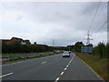
A40 Dual Carriageway
View west along the main road that skirts round the northern side of Gloucester. The houses on the left are in Cypress Gardens and the footbridge joins that road with Penrose Rd on the right hand side.
Image: © Nigel Mykura
Taken: 30 Sep 2012
0.21 miles