
IMAGES TAKEN NEAR TO
Hollywell Road, MITCHELDEAN, GL17 0DW
Introduction
This page details the photographs taken nearby to Hollywell Road, GL17 0DW by members of the Geograph project.
The Geograph project started in 2005 with the aim of publishing, organising and preserving representative images for every square kilometre of Great Britain, Ireland and the Isle of Man.

There are currently over 7.5m images from over14,400 individuals and you can help contribute to the project by visiting https://www.geograph.org.uk
Image Map
Images are licensed for reuse under creativecommons.org/licenses/by-sa/2.0
Notes
- Clicking on the map will re-center to the selected point.
- The higher the marker number, the further away the image location is from the centre of the postcode.
Image Listing (16 Images Found)
Images are licensed for reuse under creativecommons.org/licenses/by-sa/2.0
Image
Details
Distance
1
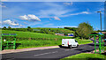
Carisbrooke Road, Mitcheldean
Two posh new bus shelters on the edge of the village.
Image: © Jonathan Billinger
Taken: 19 May 2022
0.10 miles
3
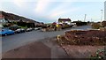
Corner of Old Dean Road, Mitcheldean
The road to the left is the old Mitcheldean to Lea road.
Image: © Jonathan Billinger
Taken: 10 Nov 2019
0.13 miles
4

Carisbrook Road, Mitcheldean, Gloucestershire
The B4224 is here named Carisbrook Road in the Forest of Dean District of Gloucestershire.
Image: © Jaggery
Taken: 17 Aug 2025
0.13 miles
5
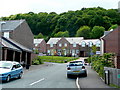
Lining Wood
The name of the recently-built housing and the woodland on the hillside beyond.
Affordable housing on the northern edge of Mitcheldean.
Image: © Jonathan Billinger
Taken: 21 May 2009
0.14 miles
6
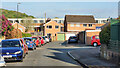
Deansway Road, Mitcheldean
The village housing is dominated by the former Rank Xerox buildings which are now a huge sprawling business park.
Image: © Jonathan Billinger
Taken: 29 Apr 2022
0.15 miles
7
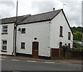
Toll House, Townend
The Old Pike House in Mitcheldean on the B4224. Originally guarding the Mitcheldean to Lea Turnpike, opened in 1769. Served Huntley and Mitcheldean Turnpike Trust.
Milestone Society National ID: GL.MDE02
Image: © Mr Red
Taken: 23 May 2022
0.17 miles
8
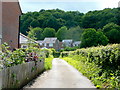
Bridleway to Lining Wood
The land to the left has been recently developed into "affordable" housing.
Image: © Jonathan Billinger
Taken: 21 May 2009
0.18 miles
9
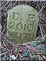
Modern Boundary Stone
On the North side of a track leading to Lining Wood, marking the boundary of the Royal Forest of Dean. Mitcheldean parish is the field on the NE side and the Forest and East Dean lie to the SW, including the top end of the nearby road also called Lining Wood.
Inscription: D. F / 1832 / Nᴼ. 179
Milestone Society National ID: GL_DFMITC179em
Image: © Mr Red
Taken: 31 Jan 2023
0.18 miles
10
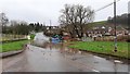
Flash flooding, Mitcheldean
Approaching the village from the north after a full 24 hours precipitation from Storm Dennis.
Image: © Jonathan Billinger
Taken: 16 Feb 2020
0.20 miles