Modern Boundary Stone
Introduction
The photograph on this page of Modern Boundary Stone by Mr Red as part of the Geograph project.
The Geograph project started in 2005 with the aim of publishing, organising and preserving representative images for every square kilometre of Great Britain, Ireland and the Isle of Man.

There are currently over 7.5m images from over 14,400 individuals and you can help contribute to the project by visiting https://www.geograph.org.uk
Modern Boundary Stone
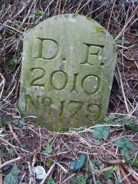
Image: © Mr Red Taken: 31 Jan 2023
On the North side of a track leading to Lining Wood, marking the boundary of the Royal Forest of Dean. Mitcheldean parish is the field on the NE side and the Forest and East Dean lie to the SW, including the top end of the nearby road also called Lining Wood. Inscription: D. F / 1832 / Nᴼ. 179 Milestone Society National ID: GL_DFMITC179em
Images are licensed for reuse under creativecommons.org/licenses/by-sa/2.0
Image Location
Latitude
51.871782
Longitude
-2.494272