
IMAGES TAKEN NEAR TO
Newland Street, COLEFORD, GL16 8AL
Introduction
This page details the photographs taken nearby to Newland Street, GL16 8AL by members of the Geograph project.
The Geograph project started in 2005 with the aim of publishing, organising and preserving representative images for every square kilometre of Great Britain, Ireland and the Isle of Man.

There are currently over 7.5m images from over14,400 individuals and you can help contribute to the project by visiting https://www.geograph.org.uk
Image Map
Images are licensed for reuse under creativecommons.org/licenses/by-sa/2.0
Notes
- Clicking on the map will re-center to the selected point.
- The higher the marker number, the further away the image location is from the centre of the postcode.
Image Listing (273 Images Found)
Images are licensed for reuse under creativecommons.org/licenses/by-sa/2.0
Image
Details
Distance
1
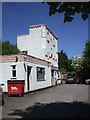
Rock Castle, Coleford
Now a dental surgery
Image: © John Lord
Taken: 24 May 2010
0.01 miles
2
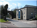
Site of former gas works, Coleford
The site is now occupied by an engineering firm, Sam Tooling Ltd. A stone inscription, "Gas Works 1840", is built into the wall of the modern building. The gas works supplied shops and houses in the town from 1840. In 1946 the Lydney Gas Company took over. Gas production ceased at Coleford in 1950 following nationalisation.
Image: © Pauline E
Taken: 15 Apr 2008
0.01 miles
3
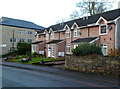
Newland Street houses, Coleford
The building in the background http://www.geograph.org.uk/photo/3258026 is part of a commercial site.
Image: © Jaggery
Taken: 12 Dec 2011
0.02 miles
4
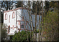
A pink and white confection
This house in Newland Street resembles a giant cake.
Image: © Pauline E
Taken: 15 Apr 2008
0.02 miles
5
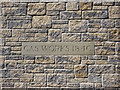
Date stone marking site of former gas works
The site is now occupied by an engineering firm, Sam Tooling Ltd. The gas works supplied shops and houses in the town from 1840. In 1946 the Lydney Gas Company took over. Gas production ceased at Coleford in 1950 following nationalisation.
Image: © Pauline E
Taken: 15 Apr 2008
0.02 miles
6
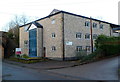
Commercial site for sale or to let, Coleford
Located alongside Newland Street on the NE side of a disused railway bridge.
Image: © Jaggery
Taken: 12 Dec 2011
0.03 miles
7
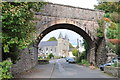
Coleford Baptist church
Coleford Baptist Church on Newland Street viewed through the old railway bridge which used to carry the Monnmouth to Coleford railway.
Image: © Philip Halling
Taken: 14 Oct 2012
0.03 miles
8
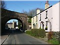
Approaching Coleford
This is the lane from Whitecliff, Newland Street, going under the former Monmouth to Coleford railway line.
Image: © Graham Horn
Taken: 27 Mar 2008
0.04 miles
9
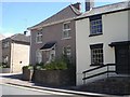
Huntingdon House, Coleford
Now Number 35 Newland Street, Huntingdon House was built in 1790 and was once a Chapel of the Countess of Huntingdon's Connection, a Calvinistic Methodist Church
Image: © Joss O'Kelly
Taken: 26 May 2009
0.04 miles
10
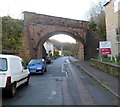
Long disused railway bridge, Coleford
The bridge crosses over Newland Street. I was surprised to find no indication of a railway line here on a 1940s map and even more so when it was not shown on a 1930s map. Further research found that there were formerly two railway stations in Coleford. The Great Western station closed in 1917 and the former Severn and Wye joint (Great Western and Midland) station closed in 1929.
Image: © Jaggery
Taken: 12 Dec 2011
0.04 miles