
IMAGES TAKEN NEAR TO
Joyford Hill, COLEFORD, GL16 7AH
Introduction
This page details the photographs taken nearby to GL16 7AH by members of the Geograph project.
The Geograph project started in 2005 with the aim of publishing, organising and preserving representative images for every square kilometre of Great Britain, Ireland and the Isle of Man.

There are currently over 7.5m images from over14,400 individuals and you can help contribute to the project by visiting https://www.geograph.org.uk
Image Map
Images are licensed for reuse under creativecommons.org/licenses/by-sa/2.0
Notes
- Clicking on the map will re-center to the selected point.
- The higher the marker number, the further away the image location is from the centre of the postcode.
Image Listing (58 Images Found)
Images are licensed for reuse under creativecommons.org/licenses/by-sa/2.0
Image
Details
Distance
1
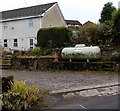
Propane tank, Joyford Hill
A warning notice on the tank shows NO SMOKING AND NO NAKED LIGHTS. Propane (C3H8) is a hydrocarbon gas, compressible to a transportable liquid (LPG). A by-product of natural gas processing and petroleum refining, propane is used as a fuel for engines, residential central heating, oxy-gas torches and portable stoves.
Image: © Jaggery
Taken: 23 Nov 2014
0.02 miles
2
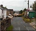
Joyford Hill descent ahead, Joyford
The triangular sign shows a 12% (between 1 in 8 and 1 in 9) descent ahead.
Image: © Jaggery
Taken: 23 Nov 2014
0.02 miles
3
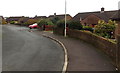
Nine Wells Close bungalows, Berry Hill
From the Nine Wells Road end.
Image: © Jaggery
Taken: 23 Nov 2014
0.03 miles
4
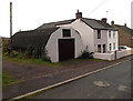
Joyford Hill Nissen hut, Joyford
Located opposite this http://www.geograph.org.uk/photo/4294459 gradient sign. First designed during the Great War (First World War),
the Nissen hut is a prefabricated steel structure, made from a semi-cylindrical skin of corrugated steel. There was no standard design. Nissen huts were used extensively during the Second World War.
Image: © Jaggery
Taken: 23 Nov 2014
0.03 miles
5
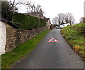
Triangular sign painted on the surface of Nine Wells Road, Berry Hill
Near the Joyford Hill junction on the approach to Berry Hill Primary School. http://www.geograph.org.uk/photo/4256578
Image: © Jaggery
Taken: 23 Nov 2014
0.04 miles
6
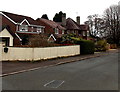
Joyford Hill houses, Coleford
Opposite the Nine Wells Road junction.
Image: © Jaggery
Taken: 23 Nov 2014
0.04 miles
7
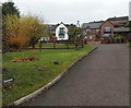
Muddles, Joyford Hill
Set back from the edge of Joyford Hill. The name sign is in the lower left corner.
Image: © Jaggery
Taken: 23 Nov 2014
0.06 miles
8
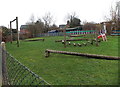
Junior level assault course, Berry Hill Primary School, Coleford
Low-level equipment and a small slide designed for primary school children.
Viewed across a Nine Wells Road fence, on the north side of the school. http://www.geograph.org.uk/photo/4256578
Image: © Jaggery
Taken: 23 Nov 2014
0.07 miles
9
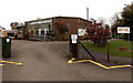
Keep Out and Welcome notices, Berry Hill Primary School, Coleford
A notice at the entrance from Nine Wells Road shows Private property. Keep out.
The board on the right shows Welcome to Berry Hill Primary School.
Image: © Jaggery
Taken: 23 Nov 2014
0.07 miles
10
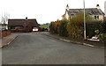
Corner of Nine Wells Road and Nine Wells Close, Berry Hill
The Nine Wells Close name sign on the right is at pavement level.
Image: © Jaggery
Taken: 23 Nov 2014
0.07 miles