
IMAGES TAKEN NEAR TO
Blakeney Hill, BLAKENEY, GL15 4BW
Introduction
This page details the photographs taken nearby to GL15 4BW by members of the Geograph project.
The Geograph project started in 2005 with the aim of publishing, organising and preserving representative images for every square kilometre of Great Britain, Ireland and the Isle of Man.

There are currently over 7.5m images from over14,400 individuals and you can help contribute to the project by visiting https://www.geograph.org.uk
Image Map
Images are licensed for reuse under creativecommons.org/licenses/by-sa/2.0
Notes
- Clicking on the map will re-center to the selected point.
- The higher the marker number, the further away the image location is from the centre of the postcode.
Image Listing (13 Images Found)
Images are licensed for reuse under creativecommons.org/licenses/by-sa/2.0
Image
Details
Distance
1
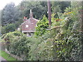
House on Loiterpin
A cottage hidden in the vegetation on a narrow lane with a strange name.
Image: © M J Richardson
Taken: 27 Sep 2013
0.16 miles
2
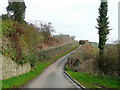
Loiterpin Lane
A narrow lane heading north between Blakeney Hill and Brain's Green.
Image: © Jonathan Billinger
Taken: 6 Apr 2010
0.16 miles
3
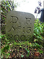
Modern Boundary Stone, Loiterpin, Blakeney Hill
On the roadside at the entrance to a property.
Inscription: D. F. / Nᴼ. 15 / 2005
Milestone Society National ID: GL_DFAWRE15em
Image: © Mr Red
Taken: 4 Oct 2022
0.16 miles
4
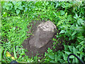
Boundary Stone, Loiterpin, Forest of Dean
Blakeney Hill, on the Eastern side of the road in the verge. Though lain and broken, it was in the exact location (1 m) of that predicted, and it has the same rounded top as many of the similar older boundary stones in the "Forest".
Milestone Society National ID: GL_DFAWRE13aem
Image: © Mr Red
Taken: 4 Oct 2022
0.19 miles
5
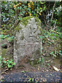
Boundary Stone, Loiterpin, Blakeney Hill
In the Eastern bank of Loiterpin.
Inscription: (D. F) / Nᴼ. 17 / (1)832
Milestone Society National ID: GL_DFAWRE17em
Image: © Mr Red
Taken: 4 Oct 2022
0.19 miles
6
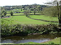
Farmland at the edge of the Forest of Dean
Looking across Forge Brook the farmland rises up towards the edge of the Forest of Dean. The road from Blakeney to Upper Soudley runs along the lower tree line.
Image: © Vincent Jones
Taken: 3 May 2006
0.20 miles
7
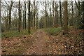
Forestry on Blakeney Hill
Woodland on the edge of the Forest of Dean on Blakeney Hill.
Image: © Philip Halling
Taken: 7 Feb 2015
0.21 miles
8
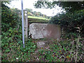
Stone Stile, Blakeney Hill
On Gloucestershire footpaths DAW38 & DAW39 from Cinderford Road opposite Hewell's Farm looking from the road. The view looking to the road is Image
Image: © Mr Red
Taken: 4 Oct 2022
0.21 miles
9
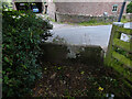
Stone Stile, Blakeney Hill
On Gloucestershire footpaths DAW38 & DAW39 from Cinderford Road, looking towards Hewell's Farm. The view from the road is Image
Image: © Mr Red
Taken: 4 Oct 2022
0.21 miles
10
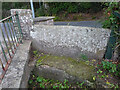
Stone Stile, Blakeney Hill
On Gloucestershire footpath DAW37 at Hewell's Farm, Cinderford Road. This looks West to road, the view East is Image
Image: © Mr Red
Taken: 4 Oct 2022
0.22 miles