
IMAGES TAKEN NEAR TO
Railway Road, CINDERFORD, GL14 3HL
Introduction
This page details the photographs taken nearby to Railway Road, GL14 3HL by members of the Geograph project.
The Geograph project started in 2005 with the aim of publishing, organising and preserving representative images for every square kilometre of Great Britain, Ireland and the Isle of Man.

There are currently over 7.5m images from over14,400 individuals and you can help contribute to the project by visiting https://www.geograph.org.uk
Image Map
Images are licensed for reuse under creativecommons.org/licenses/by-sa/2.0
Notes
- Clicking on the map will re-center to the selected point.
- The higher the marker number, the further away the image location is from the centre of the postcode.
Image Listing (32 Images Found)
Images are licensed for reuse under creativecommons.org/licenses/by-sa/2.0
Image
Details
Distance
1
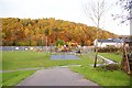
Ruspidge recreation field, Forest of Dean
This view of the Ruspidge recreation field shows the work currently in progress to provide a MUGA (Multi Use Games Area). When completed it will have an all weather surface and solar powered, movement activated lighting. The Recreation field can be found on the Western side of Ruspidge road and it gently slopes down to Cinderford brook.
Image: © Eric Soons
Taken: 9 Nov 2008
0.05 miles
2
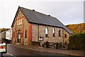
Ruspidge Memorial Hall, Forest of Dean
Ruspidge memorial hall, built to remember the sacrifices of two world wars, is a spacious and well-used hall. It is on Western, that is the Forest, side of Ruspidge road.
Image: © Eric Soons
Taken: 9 Nov 2008
0.07 miles
3
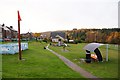
Recreational field, Ruspidge, Forest of Dean
The Recreational field at Ruspidge is very popular with the local children. The blue structure is a waist high maze for the very young whilst for the more sedate there is a covered modernistic bench, with associated waste bin. I don't know the purpose of the orange cone on top of the red pole ... but I'm sure it is very important.
Image: © Eric Soons
Taken: 10 Nov 2008
0.09 miles
4
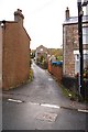
Nrs 40-49 Ruspidge Road, Ruspidge, Forest of Dean
As often happened in the Forest, ribbon development in the chaotic past along spur lanes created anomalies such as this. A little cluster of dwellings on a one-time track but which now has a metalled, if unmarked, surface has at some time been incorporated into the house numbering scheme for its parent road. Nearby there is an instance of two houses both numbered 18A in the same road - who'd be a postman!
Image: © Eric Soons
Taken: 9 Nov 2008
0.10 miles
5
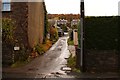
Kibbles Lane, Ruspidge, Forest of Dean
Almost immediately opposite Ruspidge Memorial Hall is this cul de sac. Although surfaced with tarmac after a fashion it is only wide enough for a small car. Ruspidge road, from where this photo was taken, runs North/South and this view is on the Eastern side of the road facing up the valley slope.
Image: © Eric Soons
Taken: 10 Nov 2008
0.12 miles
6
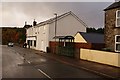
Ruspidge local shop, Forest of Dean
This, the shop with no-name, used to be Costcutters but currently has no name and is the sole remaining shop in the parish. The new bus stop is distinguished from most of the Forest bus stops by having the name of the provider (Ruspidge Parish Council) emblazoned on the gable ends. This view of Ruspidge road is facing South with the Forest, as ever, within sight.
Image: © Eric Soons
Taken: 9 Nov 2008
0.12 miles
7
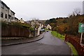
Cullimore view, Ruspidge, Forest of Dean
This is a relatively new development of higher end local housing. It is built at the very edge of Cinderford brook on what was once its diminutive flood plain. Cullimore view is vaguely sickle shaped and it 'closed' side faces West with close viewing of the Forest, which here is mainly beech.
Image: © Eric Soons
Taken: 11 Nov 2008
0.13 miles
8
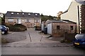
Brinton's Dairy, Ruspidge, Forest of Dean
Actually it is more of a milk delivery depot than a dairy. The small building with the 'up and over' door is where the milk is stored before being delivered to the doorsteps of customers. The dairy is located on the Eastern side of Ruspidge road.
Image: © Eric Soons
Taken: 9 Nov 2008
0.14 miles
9
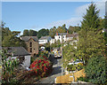
Railway Road, Ruspidge
A narrow lane leading down to the route of a former railway line.
Image: © Des Blenkinsopp
Taken: 24 Sep 2019
0.14 miles
10
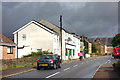
Expecting Rain, Ruspidge Road
Last of the sun before a bit of a downpour.
Image: © Des Blenkinsopp
Taken: 24 Sep 2019
0.14 miles