1
Everlands houses, Cam
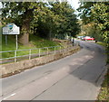
These houses are at the southern end of a road named Everlands,
along a short spur adjacent to the Church Road/Kingshill Lane junction.
Image: © Jaggery
Taken: 7 Oct 2012
0.12 miles
2
Disused footbridge
There is little evidence of the original railway line here but the footbridge remains open and is useable although there is a level path.
Image: © don cload
Taken: 21 Mar 2018
0.12 miles
3
The New Vale Community Hospital
Lister Road (new)
Image: © richard ellis
Taken: 20 Jul 2012
0.18 miles
4
Woodview Road, Wotton under Edge
This pleasant residential road dates from the 1960s or 1970s to judge from the style of the properties.
Image: © Brian Robert Marshall
Taken: 22 Apr 2008
0.20 miles
5
Woodview Road and Birch Road, Wotton under Edge
The road to the right is Birch Road. It provides access to and from this pleasant residential area.
Image: © Brian Robert Marshall
Taken: 22 Apr 2008
0.21 miles
6
Cam church
Cam church is dedicated to St George and is reputed to have been rebuilt in around 1340 by Lord Berkeley, following the murder of Edward II. The church is Grade I listed, see: https://historicengland.org.uk/listing/the-list/list-entry/1340962
Image: © Philip Halling
Taken: 4 Aug 2018
0.23 miles
7
Ricardo Drive, Cam
Ricardo Drive is a recently built cul-de-sac of 20 houses, viewed across Church Road, Upper Cam.
Image: © Jaggery
Taken: 7 Oct 2012
0.23 miles
8
River Cam, Upper Cam
Viewed from Church Road. The River Cam was formerly a tributary of the River Severn into which it flowed at Frampton Pill, Frampton on Severn. Since the opening of the Gloucester and Sharpness Canal in 1827, the Cam has emptied into the canal.
Image: © Jaggery
Taken: 7 Oct 2012
0.24 miles
9
Southern boundary of Cam
Kingshill Lane, from Dursley, reaches the village of Cam, Gloucestershire.
Image: © Jaggery
Taken: 7 Oct 2012
0.24 miles
10
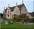
Former National School, Upper Cam
Viewed from the churchyard of The Parish Church of St George. http://www.geograph.org.uk/photo/3184119
Now two semi-detached houses, the building was formerly a school.
AD 1836 and NATIONAL SCHOOLS are engraved on the wall.
Image: © Jaggery
Taken: 7 Oct 2012
0.24 miles


