Former National School, Upper Cam
Introduction
The photograph on this page of Former National School, Upper Cam by Jaggery as part of the Geograph project.
The Geograph project started in 2005 with the aim of publishing, organising and preserving representative images for every square kilometre of Great Britain, Ireland and the Isle of Man.

There are currently over 7.5m images from over 14,400 individuals and you can help contribute to the project by visiting https://www.geograph.org.uk
Former National School, Upper Cam
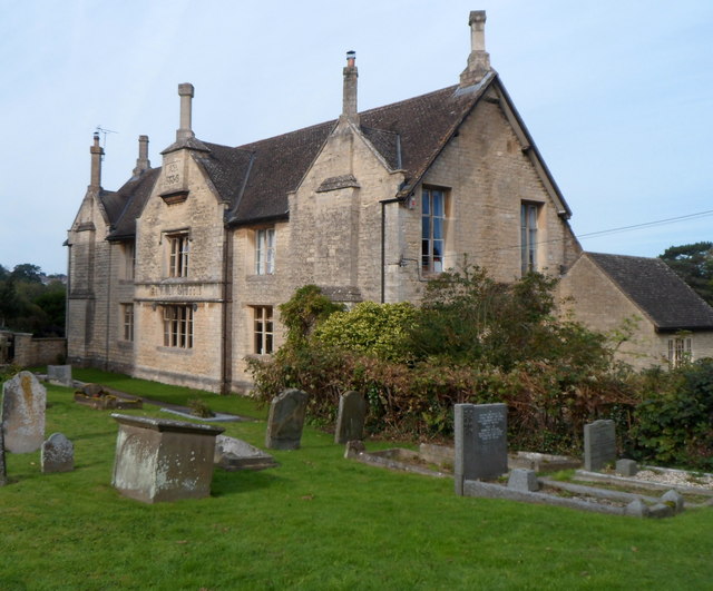
Image: © Jaggery Taken: 7 Oct 2012
Viewed from the churchyard of The Parish Church of St George. http://www.geograph.org.uk/photo/3184119 Now two semi-detached houses, the building was formerly a school. AD 1836 and NATIONAL SCHOOLS are engraved on the wall.
Images are licensed for reuse under creativecommons.org/licenses/by-sa/2.0
Image Location
Latitude
51.69264
Longitude
-2.352953